
Magnitude |
2.9 |
| Date & Time (UTC) | 2013-03-10 06:41:06.7 |
| Date & Time (Local) | 1391/12/20 10:11:06.7 |
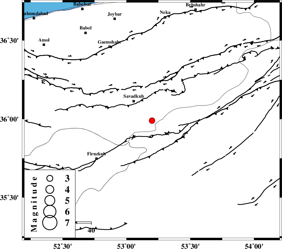
| Location | Lat:35.99 Lon: 53.2 |
| Region | Mazandaran Province, 19 km South-East of Pol-E-Sefid |
Nearest Cities |
|
| 9 km of Sangdeh, Mazandaran Province | |
| 12 km North of Chashem, Semnan Province | |
| 17 km South East of Shurmast-e peyrudbar, Mazandaran Province | |
| 19 km South East of Pol-E-Sefid, Mazandaran Province | |
| 23 km South East of Elahband, Mazandaran Province | |
| Depth | 16 km |
| Agency | |
Faults within 150 km: |
|
| N_ALBORZ_F (Length: 360 km) , Distance to epicenter: 24 km | |
| ATARI_F (Length: 185 km) , Distance to epicenter: 35 km | |
| KHAZAR_F (Length: 523 km) , Distance to epicenter: 57 km | |
| Number of Phases | 6 |
| RMS | 0.3 |
| Number of Stations | 6 |
| Error in Latitude | >9.1 km |
| Error in Longitude | 3.5 km |
| Error in Depth | 8.8 km |
Download waveform in seisan format
to download seisan software Click here
to access information about IIEES stations Click here
Amplitude | ||||||||
| UID | Agency | Station | Component | Amplitude | Period | Arrival Time | Proccessing Time | Signal Clip |
| 88164 | IIEES | THKV | N | 111.8 | 0.64 | 2013-03-10 06:42:17 | 2013-03-10 06:59:00 | n |
Phase | ||||||||||||
| Agency | Station | Component | Phase Type | Phase Quality | First Motion | Observed Arrival Time | Time Residual | Loc. Flag | Input Weight | Distance | Azimuth | |
| IIEES | CHTH | Z | Pg | E | 2013-03-10 06:41:37 | 0 | y | 187 | 268 | |||
| IIEES | THKV | Z | Pn | E | 2013-03-10 06:41:40 | 0.05 | y | 209 | 268 | |||
| IIEES | SHRO | Z | Pn | E | 2013-03-10 06:41:45 | 0.05 | y | 254 | 89 | |||
| IIEES | ASAO | Z | Pn | E | 2013-03-10 06:41:54 | -0.43 | y | 330 | 242 | |||
| IIEES | KHMZ | Z | Pn | E | 2013-03-10 06:42:02 | 0.44 | y | 387 | 231 | |||
| IIEES | TABS | Z | Pn | E | 2013-03-10 06:42:09 | -0.11 | y | 443 | 125 | |||