
Magnitude |
3.6 |
| Date & Time (UTC) | 2013-03-21 17:45:12.7 |
| Date & Time (Local) | 1392/1/1 21:15:12.7 |
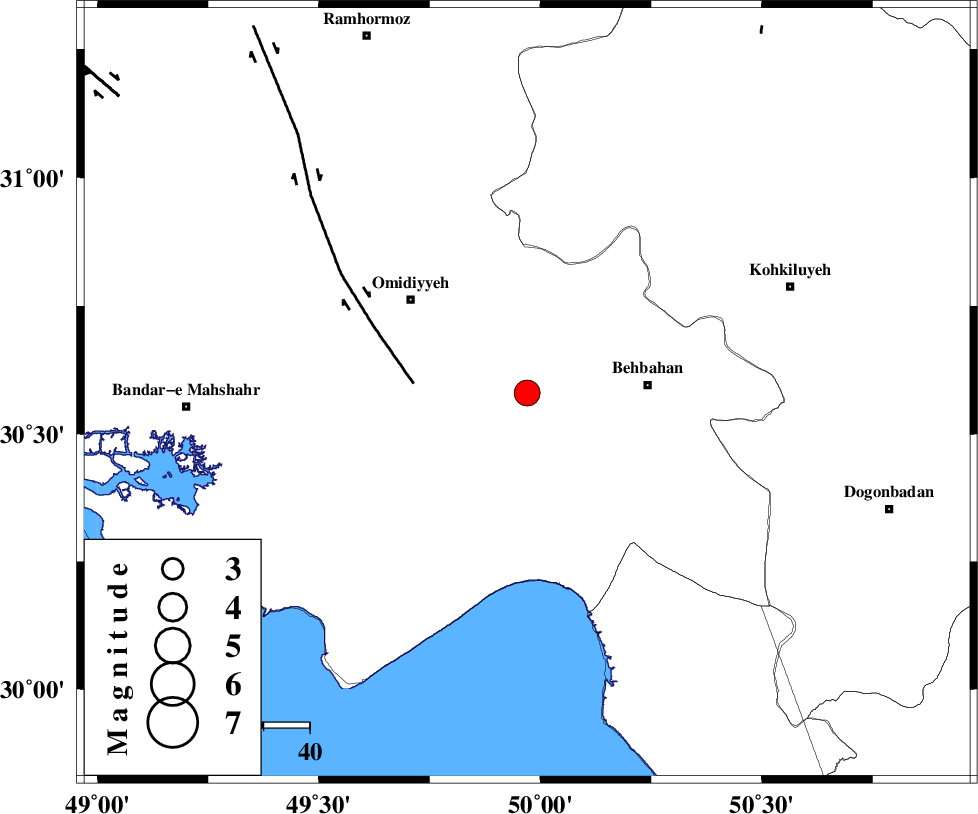
| Location | Lat:30.58 Lon: 49.97 |
| Region | Khoozestan Province, 26 km West of Behbahan |
Nearest Cities |
|
| 18 km East of Asiyab, Khoozestan Province | |
| 18 km South East of Aghajari, Khoozestan Province | |
| 25 km South West of Dodange-ye bozorg, Khoozestan Province | |
| 26 km West of Behbahan, Khoozestan Province | |
| 26 km North of Darunak, Khoozestan Province | |
| Depth | 27 km |
| Agency | |
Faults within 150 km: |
|
| AGHAJARI_F (Length: 88 km) , Distance to epicenter: 11 km | |
| RAG_E_SEFID_F (Length: 84 km) , Distance to epicenter: 18 km | |
| MFF4 (Length: 62 km) , Distance to epicenter: 40 km | |
| Number of Phases | 6 |
| RMS | 0.1 |
| Number of Stations | 6 |
| Error in Latitude | >3 km |
| Error in Longitude | 5.9 km |
| Error in Depth | 7.1 km |
Download waveform in seisan format
to download seisan software Click here
to access information about IIEES stations Click here
Amplitude | ||||||||
| UID | Agency | Station | Component | Amplitude | Period | Arrival Time | Proccessing Time | Signal Clip |
| 88282 | IIEES | SNGE | N | 33.3 | 0.72 | 2013-03-21 17:47:36 | 2013-03-21 06:07:00 | n |
| 88283 | IIEES | SNGE | E | 37.5 | 0.64 | 2013-03-21 17:47:37 | 2013-03-21 06:07:00 | n |
Phase | ||||||||||||
| Agency | Station | Component | Phase Type | Phase Quality | First Motion | Observed Arrival Time | Time Residual | Loc. Flag | Input Weight | Distance | Azimuth | |
| IIEES | SHGR | Z | Pg | E | 2013-03-21 17:45:45 | 0 | y | 203 | 327 | |||
| IIEES | AHRM | Z | Pn | E | 2013-03-21 17:45:47 | -0.07 | y | 229 | 146 | |||
| IIEES | KHMZ | Z | Pn | E | 2013-03-21 17:46:03 | 0.2 | y | 351 | 360 | |||
| IIEES | GHIR | Z | Pn | E | 2013-03-21 17:46:07 | 0.16 | y | 387 | 130 | |||
| IIEES | YZKH | Z | Pn | E | 2013-03-21 17:46:19 | -0.17 | y | 483 | 64 | |||
| IIEES | SNGE | Z | Pn | E | 2013-03-21 17:46:28 | -0.19 | y | 558 | 335 | |||