
Magnitude |
2.7 |
| Date & Time (UTC) | 2013-03-22 04:02:50.2 |
| Date & Time (Local) | 1392/1/2 08:32:50.2 |
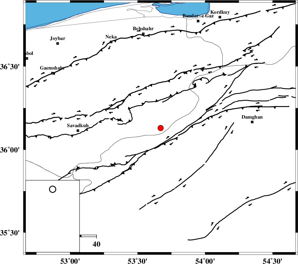
| Location | Lat:36.13 Lon: 53.67 |
| Region | Mazandaran Province, 55 km East of Pol-E-Sefid |
Nearest Cities |
|
| 10 km of Talma darreh, Mazandaran Province | |
| 16 km South East of Kiasar, Mazandaran Province | |
| 26 km North West of Darvar, Semnan Province | |
| 36 km South East of Khalkhil, Mazandaran Province | |
| 40 km North East of Sangdeh, Mazandaran Province | |
| Depth | 18 km |
| Agency | |
Faults within 150 km: |
|
| DAMGHAN_F (Length: 95 km) , Distance to epicenter: 15 km | |
| N_ALBORZ_F (Length: 360 km) , Distance to epicenter: 30 km | |
| ATARI_F (Length: 185 km) , Distance to epicenter: 31 km | |
| Number of Phases | 4 |
| RMS | 0 |
| Number of Stations | 4 |
| Error in Latitude | >5.6 km |
| Error in Longitude | 1.5 km |
| Error in Depth | 4.8 km |
Download waveform in seisan format
to download seisan software Click here
to access information about IIEES stations Click here
Amplitude | ||||||||
| UID | Agency | Station | Component | Amplitude | Period | Arrival Time | Proccessing Time | Signal Clip |
| 88288 | IIEES | GHVR | E | 39.3 | 0.36 | 2013-03-22 04:04:19 | 2013-03-22 04:29:00 | n |
| 88289 | IIEES | GHVR | N | 33.1 | 0.48 | 2013-03-22 04:04:19 | 2013-03-22 04:29:00 | n |
Phase | ||||||||||||
| Agency | Station | Component | Phase Type | Phase Quality | First Motion | Observed Arrival Time | Time Residual | Loc. Flag | Input Weight | Distance | Azimuth | |
| IIEES | DAMV | Z | Pg | E | 2013-03-22 04:03:17 | 0.01 | y | 163 | 251 | |||
| IIEES | SHRO | Z | Pn | E | 2013-03-22 04:03:23 | -0.03 | y | 212 | 93 | |||
| IIEES | SHRO | E | Sg | E | 2013-03-22 04:03:50 | 0.02 | y | 212 | 93 | |||
| IIEES | MRVT | Z | Pn | E | 2013-03-22 04:03:31 | 0.01 | y | 275 | 51 | |||