
Magnitude |
2.3 |
| Date & Time (UTC) | 2013-03-27 15:26:43.3 |
| Date & Time (Local) | 1392/1/7 19:56:43.3 |
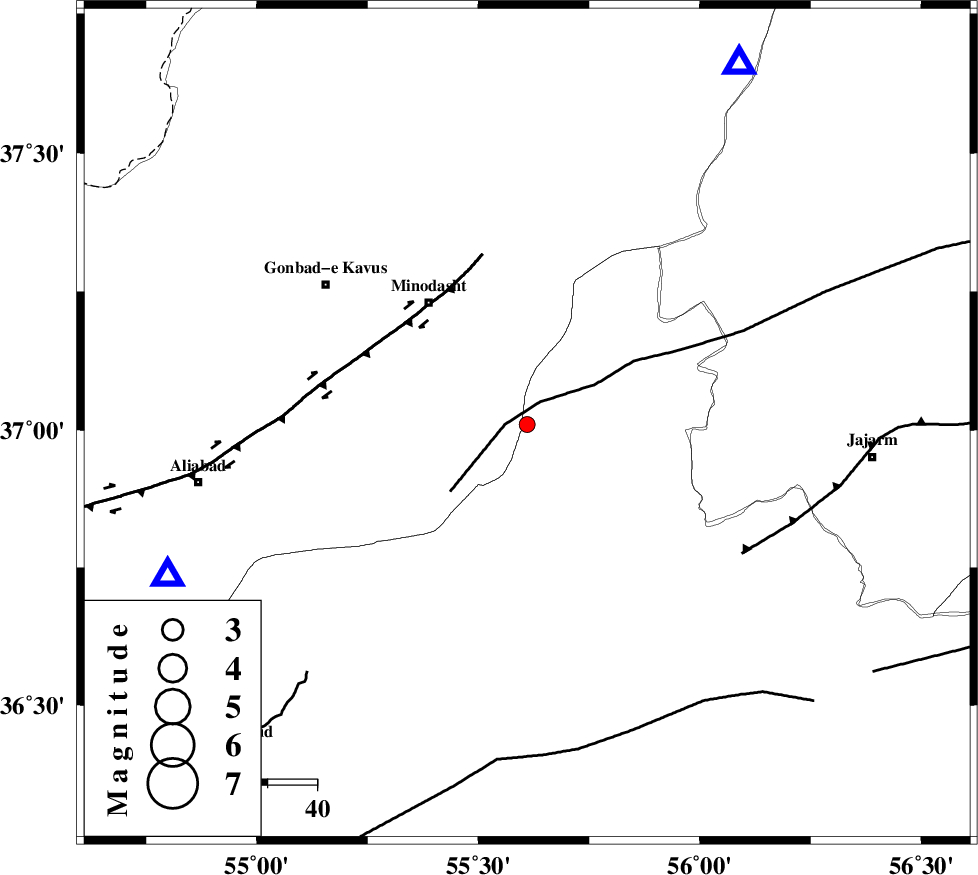
| Location | Lat:37.01 Lon: 55.61 |
| Region | Semnan Province, 31 km South-East of Minodasht |
Nearest Cities |
|
| 3 km North of Qaleh qafeh, Semnan Province | |
| 11 km East of Qale-ye qafeh, Golestan Province | |
| 13 km South of Duzin, Golestan Province | |
| 14 km South of Rezvan, Semnan Province | |
| 16 km West of Nardin, Semnan Province | |
| Depth | 14 km |
| Agency | |
Faults within 150 km: |
|
| ROBATE_QARABIL_F (Length: 168 km) , Distance to epicenter: 4 km | |
| SHAVAR_F (Length: 87 km) , Distance to epicenter: 44 km | |
| JAJARAM_F (Length: 77 km) , Distance to epicenter: 50 km | |
| Number of Phases | 4 |
| RMS | 0.2 |
| Number of Stations | 3 |
| Error in Latitude | >3.3 km |
| Error in Longitude | 6.3 km |
| Error in Depth | 7.2 km |
Download waveform in seisan format
to download seisan software Click here
to access information about IIEES stations Click here
Amplitude | ||||||||
| UID | Agency | Station | Component | Amplitude | Period | Arrival Time | Proccessing Time | Signal Clip |
| 88324 | IIEES | MRVT | E | 124.2 | 0.44 | 2013-03-27 15:27:09 | 2013-03-27 03:49:00 | n |
| 88325 | IIEES | SHRO | N | 60.4 | 0.24 | 2013-03-27 15:27:20 | 2013-03-27 03:49:00 | n |
| 88326 | IIEES | BJRD | N | 33.6 | 0.36 | 2013-03-27 15:27:37 | 2013-03-27 03:49:00 | n |
Phase | ||||||||||||
| Agency | Station | Component | Phase Type | Phase Quality | First Motion | Observed Arrival Time | Time Residual | Loc. Flag | Input Weight | Distance | Azimuth | |
| IIEES | MRVT | Z | Pg | E | 2013-03-27 15:26:57 | -0.19 | y | 83.1 | 30 | |||
| IIEES | SHRO | Z | Pg | E | 2013-03-27 15:27:02 | -0.1 | y | 117 | 162 | |||
| IIEES | BJRD | N | Pn | E | 2013-03-27 15:27:13 | 0.37 | y | 176 | 64 | |||
| IIEES | BJRD | E | Sg | E | 2013-03-27 15:27:33 | -0.08 | y | 176 | 64 | |||