
Magnitude |
3.7 |
| Date & Time (UTC) | 2013-04-12 09:24:28.2 |
| Date & Time (Local) | 1392/1/23 13:54:28.2 |
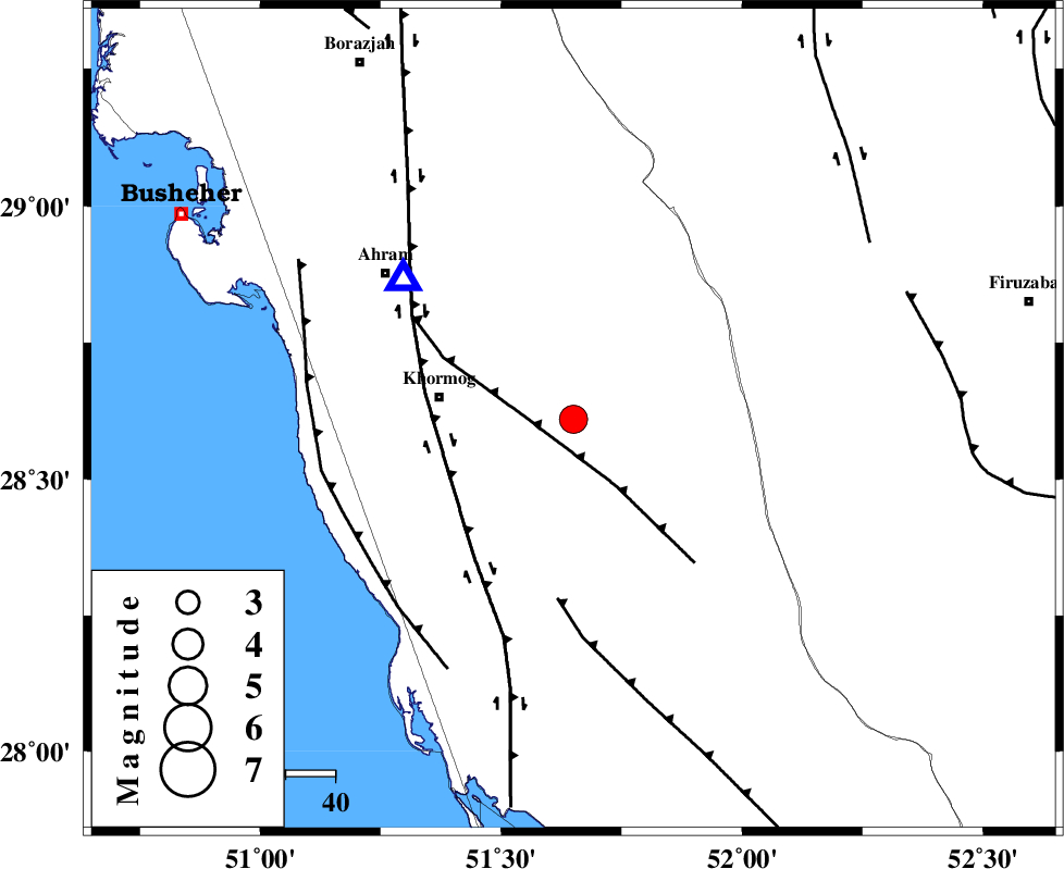
| Location | Lat:28.61 Lon: 51.65 |
| Region | Bushehr Province, 28 km East of Khormog |
Nearest Cities |
|
| 27 km North West of Shanbeh, Bushehr Province | |
| 28 km North East of Buheyri, Bushehr Province | |
| 28 km East of Khormog, Bushehr Province | |
| 28 km North East of Baduleh, Bushehr Province | |
| 33 km North East of Kaki, Bushehr Province | |
| Depth | 18 km |
| Agency | |
Faults within 150 km: |
|
| MFF5 (Length: 74 km) , Distance to epicenter: 10 km | |
| BORAZJAN_F (Length: 168 km) , Distance to epicenter: 28 km | |
| MFF3 (Length: 292 km) , Distance to epicenter: 37 km | |
| Number of Phases | 6 |
| RMS | 0.1 |
| Number of Stations | 5 |
| Error in Latitude | >10.6 km |
| Error in Longitude | 6.1 km |
| Error in Depth | 6.7 km |
Download waveform in seisan format
to download seisan software Click here
to access information about IIEES stations Click here
Amplitude | ||||||||
| UID | Agency | Station | Component | Amplitude | Period | Arrival Time | Proccessing Time | Signal Clip |
| 88667 | IIEES | AHRM | N | 2841.5 | 0.64 | 2013-04-12 09:24:51 | 2013-04-12 11:32:00 | n |
| 88668 | IIEES | GHIR | E | 2318.7 | 0.56 | 2013-04-12 09:25:11 | 2013-04-12 11:32:00 | n |
| 88669 | IIEES | GHIR | N | 1899.9 | 0.4 | 2013-04-12 09:25:12 | 2013-04-12 11:32:00 | n |
Phase | ||||||||||||
| Agency | Station | Component | Phase Type | Phase Quality | First Motion | Observed Arrival Time | Time Residual | Loc. Flag | Input Weight | Distance | Azimuth | |
| IIEES | AHRM | Z | Pg | E | 2013-04-12 09:24:36 | -0.01 | y | 44.8 | 310 | |||
| IIEES | GHIR | Z | Pg | E | 2013-04-12 09:24:50 | -0.08 | y | 136 | 105 | |||
| IIEES | GHIR | N | Sg | E | 2013-04-12 09:25:07 | 0.09 | y | 136 | 105 | |||
| IIEES | YZKH | Z | Pn | E | 2013-04-12 09:25:38 | -0.01 | y | 505 | 33 | |||
| IIEES | KRBR | Z | Pn | E | 2013-04-12 09:25:40 | -0.11 | y | 519 | 72 | |||
| IIEES | KHMZ | Z | Pn | E | 2013-04-12 09:25:49 | 0.13 | y | 591 | 345 | |||