
Magnitude |
3.1 |
| Date & Time (UTC) | 2013-04-15 02:37:07.9 |
| Date & Time (Local) | 1392/1/26 07:07:07.9 |
| Location | Lat:35.71 Lon: 52.8 |
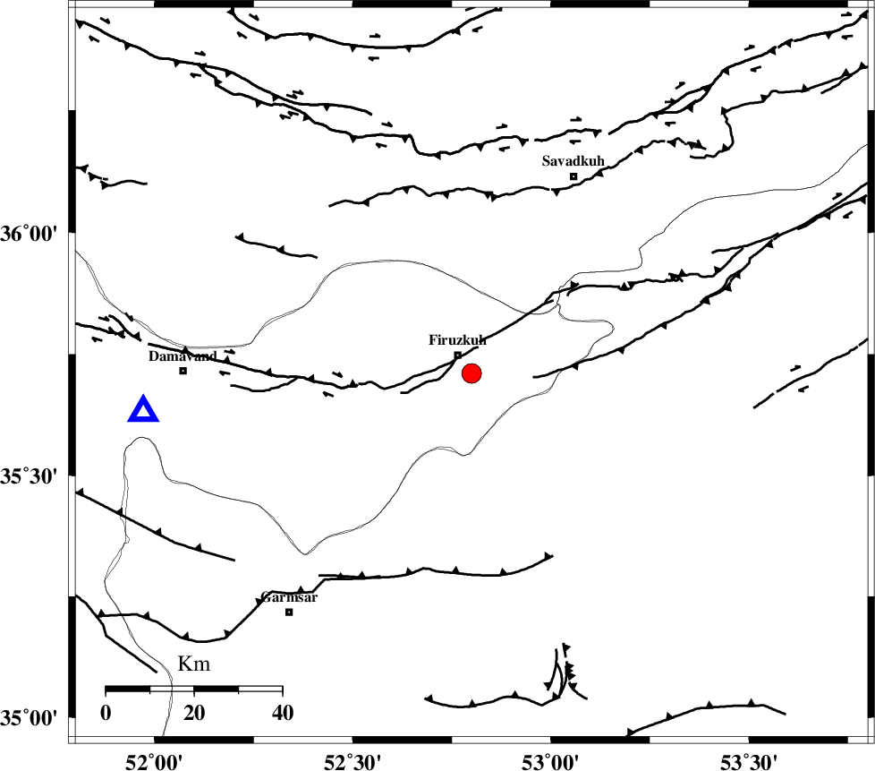
| Region | Tehran Province, 5 km Firuzkuh |
Nearest Cities |
|
| 5 km of Firuzkuh, Tehran Province | |
| 14 km East of Shahrabad, Tehran Province | |
| 22 km North East of Atashan, Tehran Province | |
| 27 km East of Arjomand, Tehran Province | |
| 31 km North West of Aftar, Semnan Province | |
| Depth | 14 km |
| Agency | |
Faults within 150 km: |
|
| MOSHA_F (Length: 234 km) , Distance to epicenter: 14 km | |
| ATARI_F (Length: 185 km) , Distance to epicenter: 14 km | |
| GARMSAR_F (Length: 77 km) , Distance to epicenter: 51 km | |
| Number of Phases | 6 |
| RMS | 0.1 |
| Number of Stations | 4 |
| Error in Latitude | >2.3 km |
| Error in Longitude | 2.8 km |
| Error in Depth | 5.6 km |
Download waveform in seisan format
to download seisan software Click here
to access information about IIEES stations Click here
Amplitude | ||||||||
| UID | Agency | Station | Component | Amplitude | Period | Arrival Time | Proccessing Time | Signal Clip |
| 88738 | IIEES | GHVR | N | 242.1 | 0.6 | 2013-04-15 02:38:11 | 2013-04-15 03:07:00 | n |
| 88739 | IIEES | GHVR | E | 268.6 | 0.32 | 2013-04-15 02:38:11 | 2013-04-15 03:07:00 | n |
| 88740 | IIEES | ASAO | E | 47.6 | 0.56 | 2013-04-15 02:38:32 | 2013-04-15 03:07:00 | n |
Phase | ||||||||||||
| Agency | Station | Component | Phase Type | Phase Quality | First Motion | Observed Arrival Time | Time Residual | Loc. Flag | Input Weight | Distance | Azimuth | |
| IIEES | CHTH | Z | Pg | E | 2013-04-15 02:37:33 | -0.2 | y | 153 | 279 | |||
| IIEES | CHTH | E | Sg | E | 2013-04-15 02:37:52 | 0.11 | y | 153 | 279 | |||
| IIEES | GHVR | Z | Pn | E | 2013-04-15 02:37:39 | -0.15 | y | 197 | 226 | |||
| IIEES | GHVR | N | Sg | E | 2013-04-15 02:38:03 | 0.03 | y | 197 | 226 | |||
| IIEES | ASAO | Z | Pn | E | 2013-04-15 02:37:51 | 0.16 | y | 284 | 244 | |||
| IIEES | SHRO | Z | Pn | E | 2013-04-15 02:37:52 | 0.07 | y | 292 | 83 | |||