
Magnitude |
2 |
| Date & Time (UTC) | 2013-04-30 18:14:04.0 |
| Date & Time (Local) | 1392/2/10 22:44:04.0 |
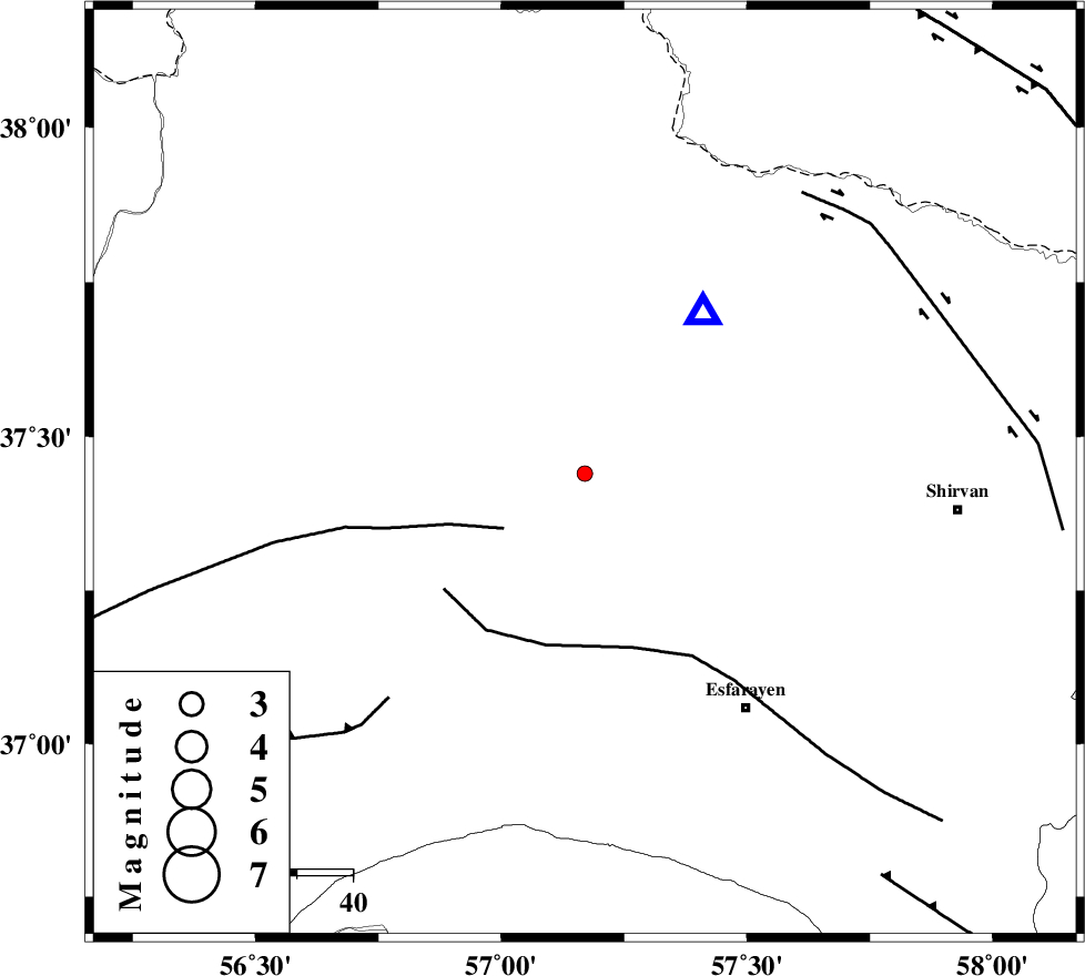
| Location | Lat:37.44 Lon: 57.17 |
| Region | Khorasan(north) Province, 15 km West of Bojnurd |
Nearest Cities |
|
| 15 km West of Bojnurd, Khorasan(north) Province | |
| 15 km West of Void, Khorasan(north) Province | |
| 24 km South East of Ashkhaneh, Khorasan(north) Province | |
| 28 km South East of Pish qaleh, Khorasan(north) Province | |
| 29 km West of Hesar-egarmkhanh, Khorasan(north) Province | |
| Depth | 15 km |
| Agency | |
Faults within 150 km: |
|
| ROBATE_QARABIL_F (Length: 168 km) , Distance to epicenter: 18 km | |
| ESFARAYEN_F (Length: 111 km) , Distance to epicenter: 32 km | |
| JAJARAM_F (Length: 77 km) , Distance to epicenter: 54 km | |
| Number of Phases | 3 |
| RMS | 0 |
| Number of Stations | 3 |
| Error in Latitude | >1.9 km |
| Error in Longitude | 2.5 km |
| Error in Depth | 0 km |
Download waveform in seisan format
to download seisan software Click here
to access information about IIEES stations Click here
Amplitude | ||||||||
| UID | Agency | Station | Component | Amplitude | Period | Arrival Time | Proccessing Time | Signal Clip |
| 89020 | IIEES | BJRD | E | 191.3 | 0.28 | 2013-04-30 18:14:18 | 2013-05-01 04:08:00 | n |
| 89021 | IIEES | MRVT | N | 45 | 0.2 | 2013-04-30 18:14:42 | 2013-05-01 04:08:00 | n |
| 89022 | IIEES | SHRO | N | 11.8 | 0.36 | 2013-04-30 18:15:02 | 2013-05-01 04:08:00 | n |
Phase | ||||||||||||
| Agency | Station | Component | Phase Type | Phase Quality | First Motion | Observed Arrival Time | Time Residual | Loc. Flag | Input Weight | Distance | Azimuth | |
| IIEES | BJRD | Z | Pg | E | 2013-04-30 18:14:10 | 0 | y | 35.7 | 36 | |||
| IIEES | MRVT | Z | Pg | E | 2013-04-30 18:14:20 | -0.01 | y | 98.8 | 285 | |||
| IIEES | SHRO | Z | Pg | E | 2013-04-30 18:14:35 | 0.01 | y | 189 | 213 | |||