
Magnitude |
3.4 |
| Date & Time (UTC) | 2013-04-10 02:26:59.3 |
| Date & Time (Local) | 1392/1/21 06:56:59.3 |
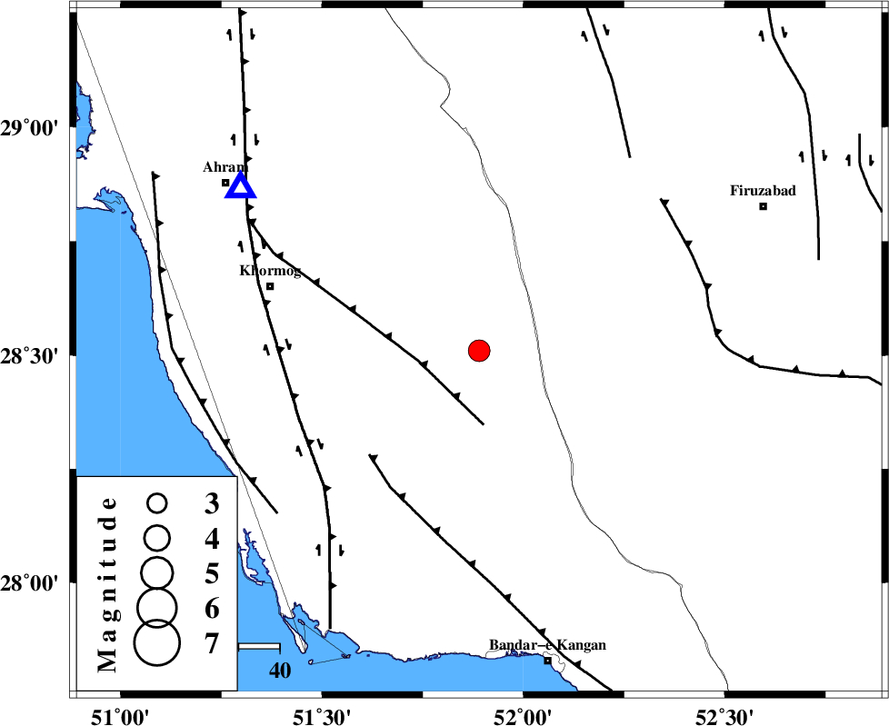
| Location | Lat:28.51 Lon: 51.89 |
| Region | Bushehr Province, 45 km South-West of Farashband |
Nearest Cities |
|
| 18 km North East of Shanbeh, Bushehr Province | |
| 41 km North East of Baduleh, Bushehr Province | |
| 41 km North West of Dahrom, Fars Province | |
| 41 km North East of Kaki, Bushehr Province | |
| 44 km South West of Farashband, Fars Province | |
| Depth | 14 km |
| Agency | |
Faults within 150 km: |
|
| MFF5 (Length: 74 km) , Distance to epicenter: 15 km | |
| MFF3 (Length: 292 km) , Distance to epicenter: 37 km | |
| BORAZJAN_F (Length: 168 km) , Distance to epicenter: 47 km | |
| Number of Phases | 5 |
| RMS | 0.1 |
| Number of Stations | 5 |
| Error in Latitude | >13.4 km |
| Error in Longitude | 7.2 km |
| Error in Depth | 12.3 km |
Download waveform in seisan format
to download seisan software Click here
to access information about IIEES stations Click here
Amplitude | ||||||||
| UID | Agency | Station | Component | Amplitude | Period | Arrival Time | Proccessing Time | Signal Clip |
| 89086 | IIEES | AHRM | E | 2024.7 | 0.55 | 2013-04-10 02:27:32 | 2013-05-01 04:08:00 | n |
| 89087 | IIEES | AHRM | N | 2339.7 | 0.73 | 2013-04-10 02:27:36 | 2013-05-01 04:08:00 | n |
Phase | ||||||||||||
| Agency | Station | Component | Phase Type | Phase Quality | First Motion | Observed Arrival Time | Time Residual | Loc. Flag | Input Weight | Distance | Azimuth | |
| IIEES | AHRM | Z | Pg | E | 2013-04-10 02:27:11 | 0.02 | y | 70.2 | 304 | |||
| IIEES | GHIR | Z | Pg | E | 2013-04-10 02:27:17 | -0.02 | y | 110 | 103 | |||
| IIEES | KRBR | Z | Pn | E | 2013-04-10 02:28:09 | 0.09 | y | 501 | 70 | |||
| IIEES | YZKH | Z | Pn | E | 2013-04-10 02:28:09 | -0.09 | y | 502 | 30 | |||
| IIEES | TABS | Z | P | E | 2013-04-10 02:28:41 | 0.03 | y | 757 | 40 | |||