
Magnitude |
3.4 |
| Date & Time (UTC) | 2013-05-06 04:01:21.1 |
| Date & Time (Local) | 1392/2/16 08:31:21.1 |
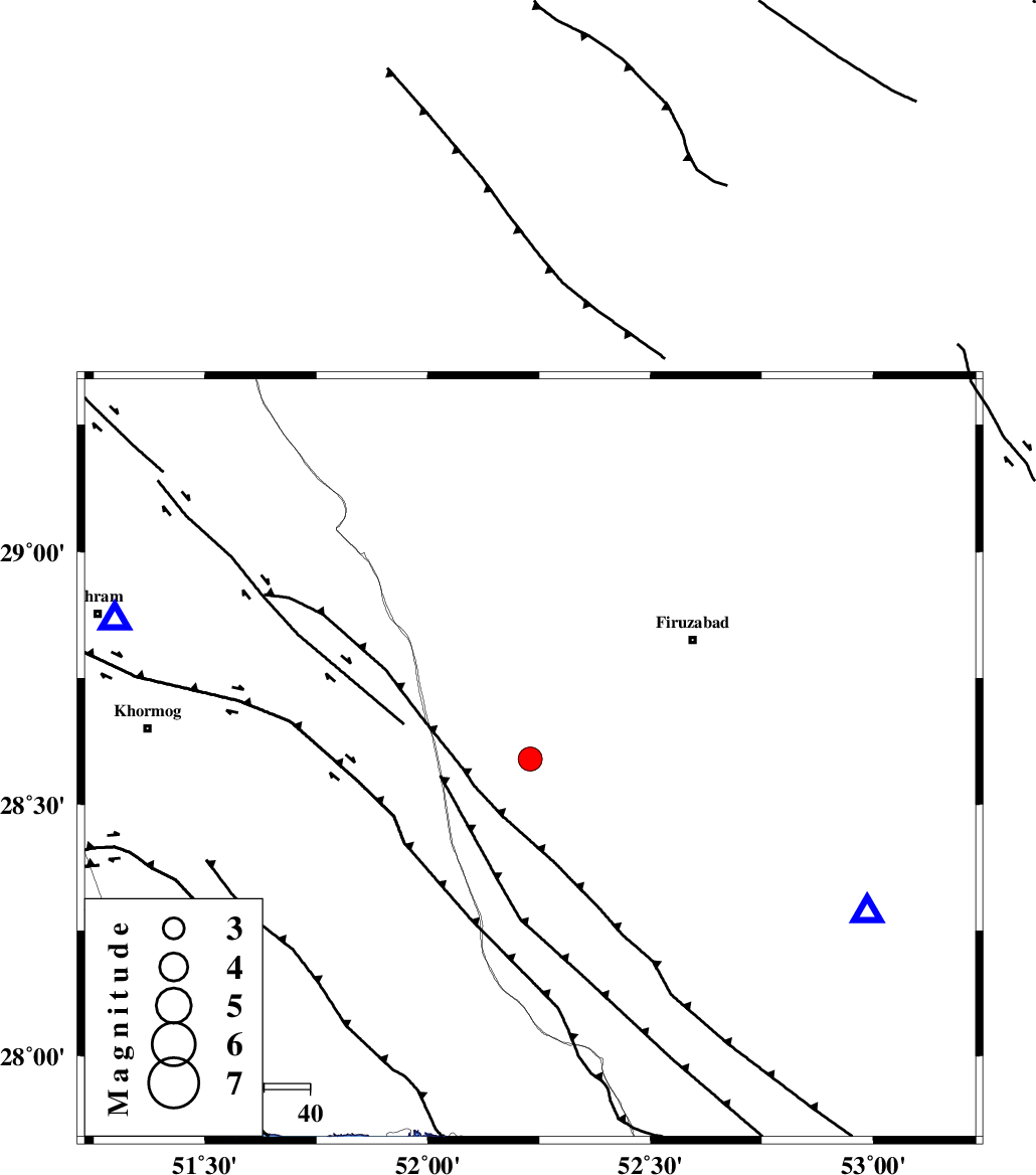
| Location | Lat:28.59 Lon: 52.23 |
| Region | Fars Province, 34 km South-East of Farashband |
Nearest Cities |
|
| 13 km North of Dahrom, Fars Province | |
| 34 km South East of Farashband, Fars Province | |
| 37 km South West of Ahmadabad, Fars Province | |
| 41 km South East of Aviz, Fars Province | |
| 44 km South West of Jaydasht, Fars Province | |
| Depth | 14 km |
| Agency | |
Faults within 150 km: |
|
| QIR_F (Length: 130 km) , Distance to epicenter: 23 km | |
| KAREBASS_F (Length: 98 km) , Distance to epicenter: 38 km | |
| MFF5 (Length: 74 km) , Distance to epicenter: 42 km | |
| Number of Phases | 4 |
| RMS | 0 |
| Number of Stations | 4 |
| Error in Latitude | >4.7 km |
| Error in Longitude | 3.1 km |
| Error in Depth | 5.7 km |
Download waveform in seisan format
to download seisan software Click here
to access information about IIEES stations Click here
Amplitude | ||||||||
| UID | Agency | Station | Component | Amplitude | Period | Arrival Time | Proccessing Time | Signal Clip |
| 89105 | IIEES | AHRM | N | 1121 | 0.55 | 2013-05-06 04:01:55 | 2013-05-06 05:30:00 | n |
| 89106 | IIEES | AHRM | E | 1142.8 | 0.3 | 2013-05-06 04:01:56 | 2013-05-06 05:30:00 | n |
Phase | ||||||||||||
| Agency | Station | Component | Phase Type | Phase Quality | First Motion | Observed Arrival Time | Time Residual | Loc. Flag | Input Weight | Distance | Azimuth | |
| IIEES | GHIR | Z | Pg | E | 2013-05-06 04:01:35 | -0.05 | y | 81.8 | 114 | |||
| IIEES | AHRM | Z | Pg | E | 2013-05-06 04:01:37 | 0 | y | 95.7 | 289 | |||
| IIEES | BNDS | Z | Pn | E | 2013-05-06 04:02:19 | 0.08 | y | 410 | 108 | |||
| IIEES | YZKH | Z | Pn | E | 2013-05-06 04:02:28 | -0.01 | y | 479 | 28 | |||