
Magnitude |
2.9 |
| Date & Time (UTC) | 2013-05-25 17:31:03.8 |
| Date & Time (Local) | 1392/3/4 22:01:03.8 |
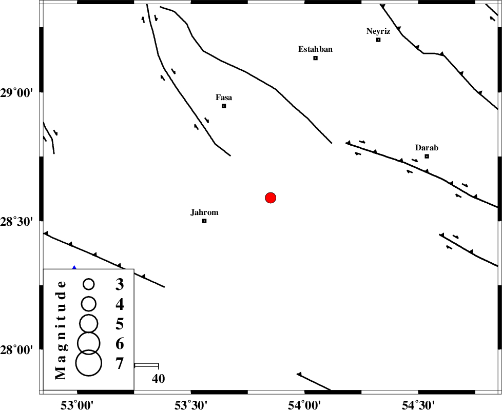
| Location | Lat:28.59 Lon: 53.85 |
| Region | Fars Province, 30 km East of Jahrom |
Nearest Cities |
|
| 11 km East of Alaviyeh, Fars Province | |
| 14 km South of Miyandeh, Fars Province | |
| 18 km South of Zahedshahr, Fars Province | |
| 19 km North East of Khorramabad, Fars Province | |
| 22 km East of Qotbabad, Fars Province | |
| Depth | 14 km |
| Agency | |
Faults within 150 km: |
|
| SARVESTAN_F (Length: 94 km) , Distance to epicenter: 25 km | |
| BAKHTEGAN_F (Length: 94 km) , Distance to epicenter: 35 km | |
| HZF1 (Length: 102 km) , Distance to epicenter: 40 km | |
| Number of Phases | 4 |
| RMS | 0 |
| Number of Stations | 3 |
| Error in Latitude | >3 km |
| Error in Longitude | 4.7 km |
| Error in Depth | 11 km |
Download waveform in seisan format
to download seisan software Click here
to access information about IIEES stations Click here
Amplitude | ||||||||
| UID | Agency | Station | Component | Amplitude | Period | Arrival Time | Proccessing Time | Signal Clip |
| 89439 | IIEES | GHIR | N | 388.1 | 0.4 | 2013-05-25 17:31:37 | 2013-05-25 07:44:00 | n |
| 89440 | IIEES | GHIR | E | 443 | 0.56 | 2013-05-25 17:31:40 | 2013-05-25 07:44:00 | n |
Phase | ||||||||||||
| Agency | Station | Component | Phase Type | Phase Quality | First Motion | Observed Arrival Time | Time Residual | Loc. Flag | Input Weight | Distance | Azimuth | |
| IIEES | GHIR | Z | Pg | E | 2013-05-25 17:31:19 | -0.03 | y | 91.3 | 248 | |||
| IIEES | GHIR | E | Sg | E | 2013-05-25 17:31:31 | 0.02 | y | 91.3 | 248 | |||
| IIEES | BNDS | Z | Pn | E | 2013-05-25 17:31:44 | 0.01 | y | 264 | 120 | |||
| IIEES | YZKH | Z | Pn | E | 2013-05-25 17:32:05 | 0.01 | y | 427 | 9 | |||