
Magnitude |
2.5 |
| Date & Time (UTC) | 2013-05-29 09:25:36.5 |
| Date & Time (Local) | 1392/3/8 13:55:36.5 |
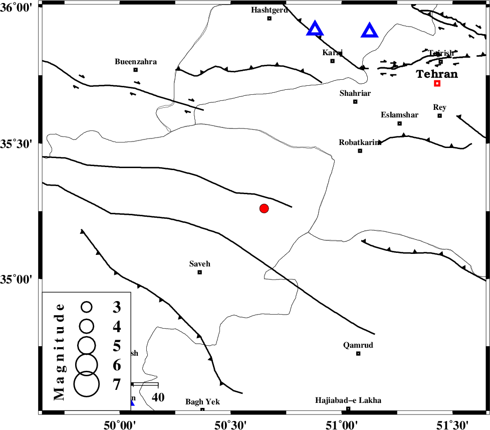
| Location | Lat:35.26 Lon: 50.65 |
| Region | Markazi Province, 37 km North-East of Saveh |
Nearest Cities |
|
| 12 km South of Rahimabad, Markazi Province | |
| 12 km East of Memunieh, Markazi Province | |
| 15 km East of Hakimabad, Markazi Province | |
| 16 km South of Zaviyeh, Markazi Province | |
| 32 km South East of Khoshkrud, Markazi Province | |
| Depth | 15 km |
| Agency | |
Faults within 150 km: |
|
| S_PARANDAK_F (Length: 116 km) , Distance to epicenter: 5 km | |
| KUSHK_E_NOSRAT_F (Length: 230 km) , Distance to epicenter: 19 km | |
| SIAHKUH_F (Length: 154 km) , Distance to epicenter: 44 km | |
| Number of Phases | 8 |
| RMS | 0.2 |
| Number of Stations | 6 |
| Error in Latitude | >2.1 km |
| Error in Longitude | 3.2 km |
| Error in Depth | 6.8 km |
Download waveform in seisan format
to download seisan software Click here
to access information about IIEES stations Click here
Amplitude | ||||||||
| UID | Agency | Station | Component | Amplitude | Period | Arrival Time | Proccessing Time | Signal Clip |
| 89467 | IIEES | DAMV | E | 91.5 | 0.15 | 2013-05-29 09:26:13 | 2013-05-29 10:46:00 | n |
Phase | ||||||||||||
| Agency | Station | Component | Phase Type | Phase Quality | First Motion | Observed Arrival Time | Time Residual | Loc. Flag | Input Weight | Distance | Azimuth | |
| IIEES | CHTH | Z | Pg | E | 2013-05-29 09:25:51 | 0.06 | y | 83.9 | 31 | |||
| IIEES | CHTH | N | Sg | E | 2013-05-29 09:26:01 | 0.07 | y | 83.9 | 31 | |||
| IIEES | ASAO | Z | Pg | E | 2013-05-29 09:25:53 | 0.16 | y | 97.4 | 216 | |||
| IIEES | GHVR | Z | Pg | E | 2013-05-29 09:25:54 | 0.32 | y | 102 | 148 | |||
| IIEES | DAMV | Z | Pg | E | 2013-05-29 09:25:57 | -0.11 | y | 127 | 71 | |||
| IIEES | DAMV | E | Sg | E | 2013-05-29 09:26:13 | -0.12 | y | 127 | 71 | |||
| IIEES | KHMZ | Z | Pg | E | 2013-05-29 09:26:05 | -0.38 | y | 180 | 201 | |||
| IIEES | NASN | Z | Pn | E | 2013-05-29 09:26:26 | 0.01 | y | 338 | 143 | |||