
Magnitude |
3.2 |
| Date & Time (UTC) | 2013-06-04 19:58:19.1 |
| Date & Time (Local) | 1392/3/15 00:28:19.1 |
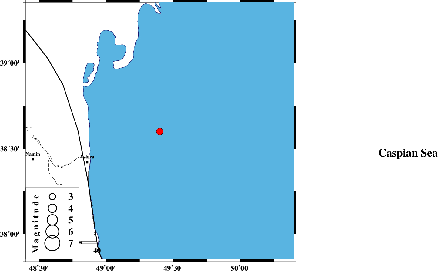
| Location | Lat:38.6 Lon: 49.4 |
| Region | Caspian Sea, 51 km North-East of Astara |
Nearest Cities |
|
| 51 km North East of Astara, Gilan Province | |
| 57 km North East of Londovil, Gilan Province | |
| 66 km North East of Hariq, Gilan Province | |
| 69 km North East of Kiladeh, Gilan Province | |
| 80 km North East of Lisar, Gilan Province | |
| Depth | 14 km |
| Agency | |
Faults within 150 km: |
|
| TALESH_F (Length: 258 km) , Distance to epicenter: 53 km | |
| SANGAVAR_F (Length: 61 km) , Distance to epicenter: 85 km | |
| BOZQUSH (Length: 70 km) , Distance to epicenter: 112 km | |
| Number of Phases | 6 |
| RMS | 0.1 |
| Number of Stations | 4 |
| Error in Latitude | >3.1 km |
| Error in Longitude | 4.9 km |
| Error in Depth | 7.3 km |
Download waveform in seisan format
to download seisan software Click here
to access information about IIEES stations Click here
Amplitude | ||||||||
| UID | Agency | Station | Component | Amplitude | Period | Arrival Time | Proccessing Time | Signal Clip |
| 89547 | IIEES | GRMI | E | 460.4 | 0.6 | 2013-06-04 19:58:59 | 2013-06-04 09:24:00 | n |
| 89548 | IIEES | GRMI | N | 407.3 | 0.52 | 2013-06-04 19:58:59 | 2013-06-04 09:24:00 | n |
Phase | ||||||||||||
| Agency | Station | Component | Phase Type | Phase Quality | First Motion | Observed Arrival Time | Time Residual | Loc. Flag | Input Weight | Distance | Azimuth | |
| IIEES | GRMI | Z | P | E | 2013-06-04 19:58:41 | 0.12 | y | 133 | 280 | |||
| IIEES | GRMI | E | Sg | E | 2013-06-04 19:58:57 | -0.1 | y | 133 | 280 | |||
| IIEES | ZNJK | Z | Pg | E | 2013-06-04 19:58:55 | -0.13 | y | 223 | 197 | |||
| IIEES | ZNJK | E | Sg | E | 2013-06-04 19:59:22 | 0.09 | y | 223 | 197 | |||
| IIEES | CHTH | Z | Pn | E | 2013-06-04 19:59:08 | -0.03 | y | 336 | 152 | |||
| IIEES | MAKU | Z | Pn | E | 2013-06-04 19:59:18 | 0.07 | y | 417 | 283 | |||