
Magnitude |
2.8 |
| Date & Time (UTC) | 2013-06-04 22:33:02.0 |
| Date & Time (Local) | 1392/3/15 03:03:02.0 |
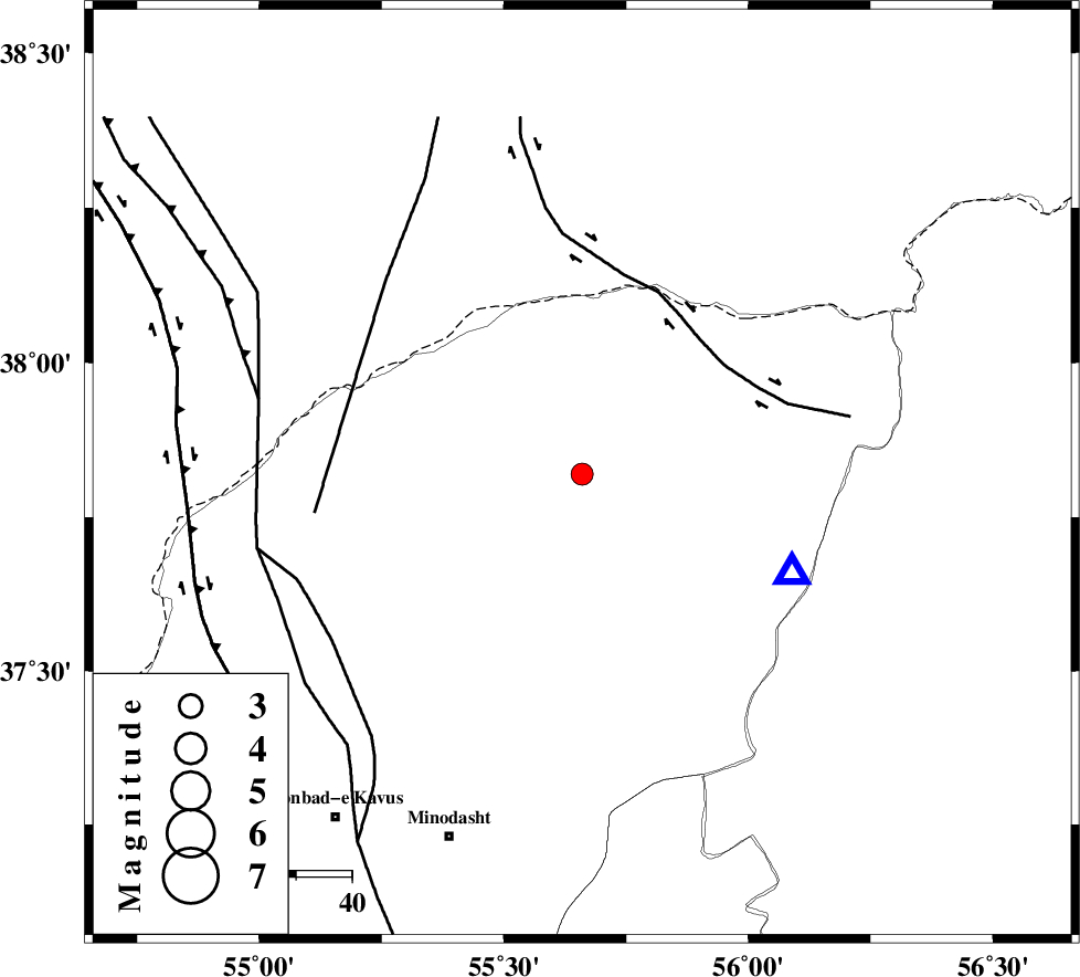
| Location | Lat:37.82 Lon: 55.66 |
| Region | Golestan Province, 51 km North-East of Kalaleh |
Nearest Cities |
|
| 16 km North East of Qareh aghaj, Golestan Province | |
| 20 km South East of Karand, Golestan Province | |
| 28 km West of Moravehtappeh, Golestan Province | |
| 32 km North West of Golidagh, Golestan Province | |
| 33 km North of Pashikmar, Golestan Province | |
| Depth | 17 km |
| Agency | |
Faults within 150 km: |
|
| ROBATE_QARABIL_F (Length: 168 km) , Distance to epicenter: 79 km | |
| KHAZAR_F (Length: 523 km) , Distance to epicenter: 109 km | |
| JAJARAM_F (Length: 77 km) , Distance to epicenter: 114 km | |
| Number of Phases | 5 |
| RMS | 0.2 |
| Number of Stations | 3 |
| Error in Latitude | >6.2 km |
| Error in Longitude | 9.6 km |
| Error in Depth | 9.6 km |
Download waveform in seisan format
to download seisan software Click here
to access information about IIEES stations Click here
Amplitude | ||||||||
| UID | Agency | Station | Component | Amplitude | Period | Arrival Time | Proccessing Time | Signal Clip |
| 89549 | IIEES | MRVT | E | 896.3 | 0.36 | 2013-06-04 22:33:16 | 2013-06-05 12:20:00 | n |
Phase | ||||||||||||
| Agency | Station | Component | Phase Type | Phase Quality | First Motion | Observed Arrival Time | Time Residual | Loc. Flag | Input Weight | Distance | Azimuth | |
| IIEES | MRVT | Z | Pg | E | 2013-06-04 22:33:09 | 0.11 | y | 41.3 | 115 | |||
| IIEES | MRVT | N | S | E | 2013-06-04 22:33:15 | -0.15 | y | 41.3 | 115 | |||
| IIEES | BJRD | Z | Pg | E | 2013-06-04 22:33:27 | 0.11 | y | 154 | 94 | |||
| IIEES | SHRO | Z | Pn | E | 2013-06-04 22:33:34 | -0.26 | y | 203 | 171 | |||
| IIEES | SHRO | E | S | E | 2013-06-04 22:33:58 | 0.18 | y | 203 | 171 | |||

 IIEES All Rights Reserved