
Magnitude |
2.5 |
| Date & Time (UTC) | 2013-06-20 16:28:59.5 |
| Date & Time (Local) | 1392/3/30 20:58:59.5 |
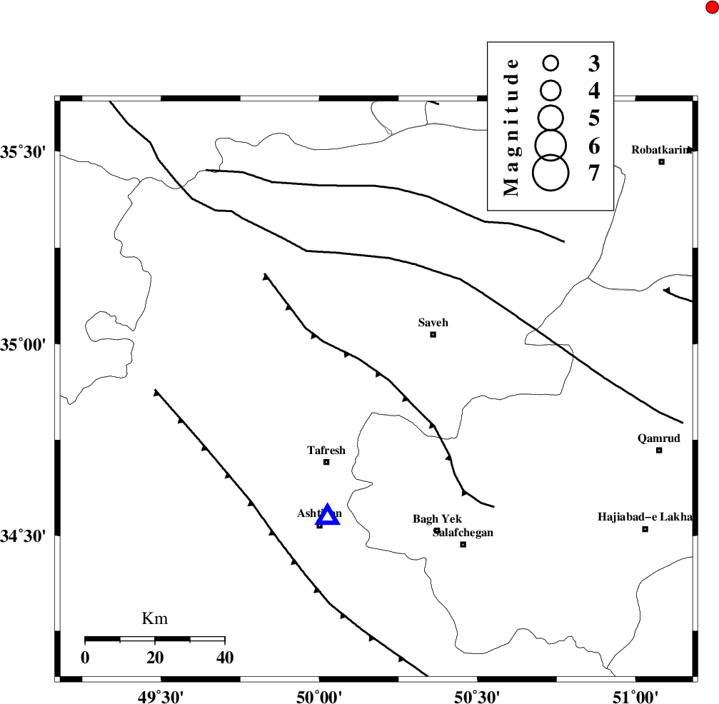
| Location | Lat:34.88 Lon: 50.18 |
| Region | Markazi Province, 23 km South-West of Saveh |
Nearest Cities |
|
| 10 km North East of Khanak, Markazi Province | |
| 14 km West of Yalabad, Markazi Province | |
| 18 km West of Qareh chay, Markazi Province | |
| 23 km South West of Saveh, Markazi Province | |
| 24 km South East of Qeytaniyeh, Markazi Province | |
| Depth | 29 km |
| Agency | |
Faults within 150 km: |
|
| INDES_F (Length: 98 km) , Distance to epicenter: 5 km | |
| KUSHK_E_NOSRAT_F (Length: 230 km) , Distance to epicenter: 38 km | |
| TAFRESH_F (Length: 117 km) , Distance to epicenter: 49 km | |
| Number of Phases | 5 |
| RMS | 0.2 |
| Number of Stations | 4 |
| Error in Latitude | >6 km |
| Error in Longitude | 6.7 km |
| Error in Depth | 5.7 km |
Download waveform in seisan format
to download seisan software Click here
to access information about IIEES stations Click here
Amplitude | ||||||||
| UID | Agency | Station | Component | Amplitude | Period | Arrival Time | Proccessing Time | Signal Clip |
| 89699 | IIEES | KHMZ | N | 88.7 | 0.56 | 2013-06-20 16:29:38 | 2013-06-20 05:54:00 | n |
Phase | ||||||||||||
| Agency | Station | Component | Phase Type | Phase Quality | First Motion | Observed Arrival Time | Time Residual | Loc. Flag | Input Weight | Distance | Azimuth | |
| IIEES | ASAO | Z | Pg | E | 2013-06-20 16:29:07 | -0.18 | y | 39.4 | 202 | |||
| IIEES | GHVR | Z | Pg | E | 2013-06-20 16:29:17 | -0.21 | y | 107 | 114 | |||
| IIEES | KHMZ | Z | Pg | E | 2013-06-20 16:29:21 | 0.32 | y | 128 | 189 | |||
| IIEES | DAMV | Z | Pn | E | 2013-06-20 16:29:28 | -0.11 | y | 183 | 62 | |||
| IIEES | DAMV | E | Sg | E | 2013-06-20 16:29:51 | 0.17 | y | 183 | 62 | |||