
Magnitude |
2.1 |
| Date & Time (UTC) | 2013-06-24 00:47:20.9 |
| Date & Time (Local) | 1392/4/3 05:17:20.9 |
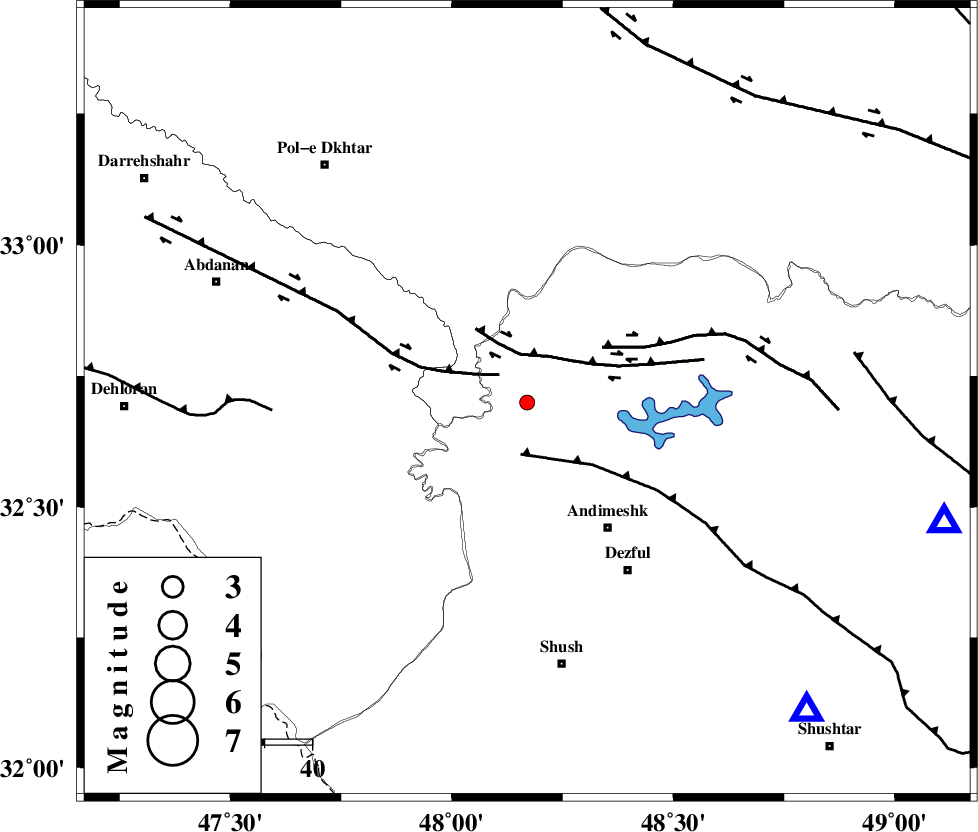
| Location | Lat:32.7 Lon: 48.17 |
| Region | Khoozestan Province, 32 km North-West of Andimeshk |
Nearest Cities |
|
| 8 km North of Hoseinieh, Khoozestan Province | |
| 9 km of Bidruyeh, Khoozestan Province | |
| 17 km West of Sorkhakan, Khoozestan Province | |
| 32 km North West of Andimeshk, Khoozestan Province | |
| 42 km North West of Dezful, Khoozestan Province | |
| Depth | 32 km |
| Agency | |
Faults within 150 km: |
|
| BALARUD_F_Z1 (Length: 87 km) , Distance to epicenter: 8 km | |
| BALARUD_F_Z3 (Length: 53 km) , Distance to epicenter: 10 km | |
| DEZFUL_EMBAYMENT (Length: 228 km) , Distance to epicenter: 11 km | |
| Number of Phases | 5 |
| RMS | 0.1 |
| Number of Stations | 4 |
| Error in Latitude | >2.2 km |
| Error in Longitude | 3.4 km |
| Error in Depth | 4.3 km |
Download waveform in seisan format
to download seisan software Click here
to access information about IIEES stations Click here
Amplitude | ||||||||
| UID | Agency | Station | Component | Amplitude | Period | Arrival Time | Proccessing Time | Signal Clip |
| 89742 | IIEES | KHMZ | E | 17.2 | 0.4 | 2013-06-24 00:48:22 | 2013-06-24 09:39:00 | n |
Phase | ||||||||||||
| Agency | Station | Component | Phase Type | Phase Quality | First Motion | Observed Arrival Time | Time Residual | Loc. Flag | Input Weight | Distance | Azimuth | |
| IIEES | SHGR | Z | Pg | E | 2013-06-24 00:47:36 | 0 | y | 88.5 | 138 | |||
| IIEES | KHMZ | Z | Pn | E | 2013-06-24 00:47:52 | -0.07 | y | 203 | 55 | |||
| IIEES | KHMZ | E | Sg | E | 2013-06-24 00:48:17 | 0 | y | 203 | 55 | |||
| IIEES | ASAO | Z | Pn | E | 2013-06-24 00:48:00 | 0.09 | y | 268 | 40 | |||
| IIEES | SNGE | Z | Pn | E | 2013-06-24 00:48:01 | -0.02 | y | 276 | 344 | |||