
Magnitude |
4.2 |
| Date & Time (UTC) | 2013-06-30 16:25:33.4 |
| Date & Time (Local) | 1392/4/9 20:55:33.4 |
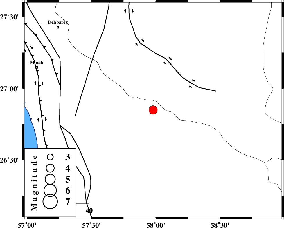
| Location | Lat:26.85 Lon: 57.98 |
| Region | Hormozgan Province, 79 km South-East of Manujan |
Nearest Cities |
|
| 29 km North of Angahran, Hormozgan Province | |
| 30 km South of Keshmiran, Kerman Province | |
| 47 km North East of Darpahn, Hormozgan Province | |
| 55 km North East of Sanadrak, Hormozgan Province | |
| 76 km South of Qalehy-eganj, Kerman Province | |
| Depth | 14 km |
| Agency | |
Faults within 150 km: |
|
| JIROFT_F (Length: 144 km) , Distance to epicenter: 34 km | |
| SABZEVARAN_F (Length: 190 km) , Distance to epicenter: 60 km | |
| ZENDAN_MINAB_F_Z2 (Length: 63 km) , Distance to epicenter: 65 km | |
| Number of Phases | 6 |
| RMS | 0.1 |
| Number of Stations | 6 |
| Error in Latitude | >1.8 km |
| Error in Longitude | 2.9 km |
| Error in Depth | 5 km |
Download waveform in seisan format
to download seisan software Click here
to access information about IIEES stations Click here
Amplitude | ||||||||
| UID | Agency | Station | Component | Amplitude | Period | Arrival Time | Proccessing Time | Signal Clip |
| 89789 | IIEES | BNDS | N | 2645 | 0.6 | 2013-06-30 16:26:07 | 2013-06-30 05:53:00 | n |
| 89790 | IIEES | KRBR | N | 527.5 | 0.6 | 2013-06-30 16:27:27 | 2013-06-30 05:53:00 | n |
| 89791 | IIEES | KRBR | E | 555.7 | 0.6 | 2013-06-30 16:27:38 | 2013-06-30 05:53:00 | n |
Phase | ||||||||||||
| Agency | Station | Component | Phase Type | Phase Quality | First Motion | Observed Arrival Time | Time Residual | Loc. Flag | Input Weight | Distance | Azimuth | |
| IIEES | CHBR | Z | P | E | 2013-06-30 16:26:16 | 0.16 | y | 286 | 119 | |||
| IIEES | CHBR | E | Sg | E | 2013-06-30 16:26:53 | -0.07 | y | 286 | 119 | |||
| IIEES | ZHSF | Z | Pn | E | 2013-06-30 16:26:32 | -0.11 | y | 411 | 41 | |||
| IIEES | GHIR | Z | Pn | E | 2013-06-30 16:26:45 | -0.11 | y | 518 | 289 | |||
| IIEES | BSRN | Z | Pn | E | 2013-06-30 16:26:53 | 0.06 | y | 578 | 11 | |||
| IIEES | BSRN | E | Sg | E | 2013-06-30 16:28:14 | 0.06 | y | 578 | 11 | |||