
Magnitude |
3.7 |
| Date & Time (UTC) | 2013-07-02 14:14:22.4 |
| Date & Time (Local) | 1392/4/11 18:44:22.4 |
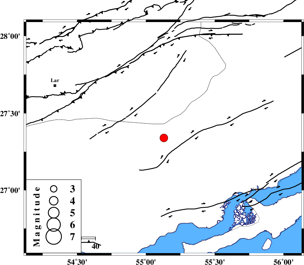
| Location | Lat:27.34 Lon: 55.13 |
| Region | Hormozgan Province, 77 km North-East of Bastak |
Nearest Cities |
|
| 63 km North West of Bandar-e khamir, Hormozgan Province | |
| 65 km South West of Darz, Fars Province | |
| 77 km North East of Bastak, Hormozgan Province | |
| 83 km South West of Fin, Hormozgan Province | |
| 84 km South East of Latifi, Fars Province | |
| Depth | 16 km |
| Agency | |
Faults within 150 km: |
|
| MFF1 (Length: 180 km) , Distance to epicenter: 31 km | |
| LAR_F (Length: 99 km) , Distance to epicenter: 43 km | |
| ZFF1 (Length: 165 km) , Distance to epicenter: 62 km | |
| Number of Phases | 5 |
| RMS | 0.1 |
| Number of Stations | 4 |
| Error in Latitude | >13.3 km |
| Error in Longitude | 6 km |
| Error in Depth | 16 km |
Download waveform in seisan format
to download seisan software Click here
to access information about IIEES stations Click here
Amplitude | ||||||||
| UID | Agency | Station | Component | Amplitude | Period | Arrival Time | Proccessing Time | Signal Clip |
| 89810 | IIEES | GHIR | N | 555.1 | 0.52 | 2013-07-02 14:15:35 | 2013-07-02 05:14:00 | n |
Phase | ||||||||||||
| Agency | Station | Component | Phase Type | Phase Quality | First Motion | Observed Arrival Time | Time Residual | Loc. Flag | Input Weight | Distance | Azimuth | |
| IIEES | GHIR | Z | Pn | E | 2013-07-02 14:14:59 | 0 | y | 236 | 297 | |||
| IIEES | GHIR | E | Sg | E | 2013-07-02 14:15:29 | 0 | y | 236 | 297 | |||
| IIEES | KRBR | Z | Pn | E | 2013-07-02 14:15:11 | 0.03 | y | 334 | 28 | |||
| IIEES | YZKH | Z | Pn | E | 2013-07-02 14:15:40 | 0.05 | y | 563 | 355 | |||
| IIEES | TABS | Z | Pn | E | 2013-07-02 14:16:00 | -0.13 | y | 726 | 15 | |||