
Magnitude |
3.2 |
| Date & Time (UTC) | 2013-07-06 18:59:52.1 |
| Date & Time (Local) | 1392/4/15 23:29:52.1 |
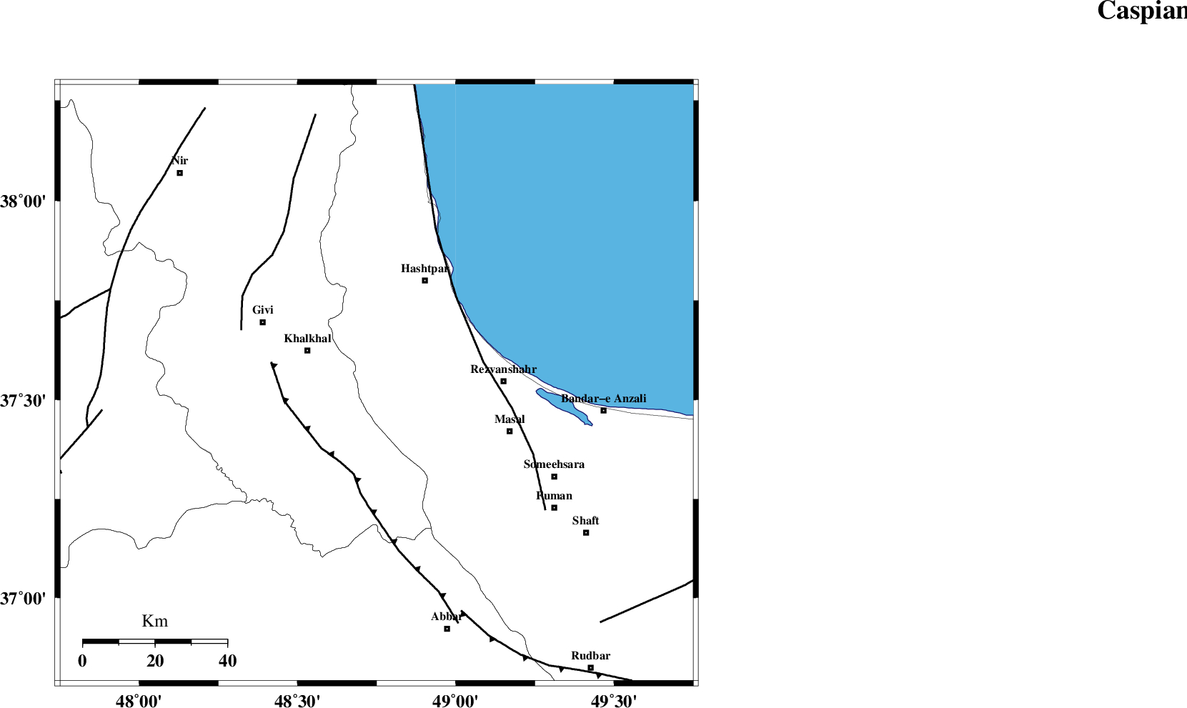
| Location | Lat:37.54 Lon: 48.75 |
| Region | Gilan Province, 21 km East of Khalkhal |
Nearest Cities |
|
| 12 km West of Ardeh, Gilan Province | |
| 17 km North of Kalur, Ardebil Province | |
| 18 km East of Khojin, Ardebil Province | |
| 21 km East of Khalkhal, Ardebil Province | |
| 23 km North of Shal, Ardebil Province | |
| Depth | 14 km |
| Agency | |
Faults within 150 km: |
|
| MASULEL_F (Length: 90 km) , Distance to epicenter: 24 km | |
| TALESH_F (Length: 258 km) , Distance to epicenter: 30 km | |
| SANGAVAR_F (Length: 61 km) , Distance to epicenter: 41 km | |
| Number of Phases | 4 |
| RMS | 0.2 |
| Number of Stations | 4 |
| Error in Latitude | >2.6 km |
| Error in Longitude | 6.3 km |
| Error in Depth | 6.4 km |
Download waveform in seisan format
to download seisan software Click here
to access information about IIEES stations Click here
Amplitude | ||||||||
| UID | Agency | Station | Component | Amplitude | Period | Arrival Time | Proccessing Time | Signal Clip |
| 89829 | IIEES | GRMI | E | 377 | 0.2 | 2013-07-06 19:00:40 | 2013-07-06 08:33:00 | n |
Phase | ||||||||||||
| Agency | Station | Component | Phase Type | Phase Quality | First Motion | Observed Arrival Time | Time Residual | Loc. Flag | Input Weight | Distance | Azimuth | |
| IIEES | ZNJK | Z | Pg | E | 2013-07-06 19:00:08 | -0.24 | y | 96.2 | 183 | |||
| IIEES | GRMI | Z | Pg | E | 2013-07-06 19:00:18 | -0.05 | y | 160 | 332 | |||
| IIEES | CHTH | Z | Pn | E | 2013-07-06 19:00:34 | 0.07 | y | 279 | 130 | |||
| IIEES | SNGE | Z | Pn | E | 2013-07-06 19:00:37 | 0.24 | y | 299 | 205 | |||