
Magnitude |
3.1 |
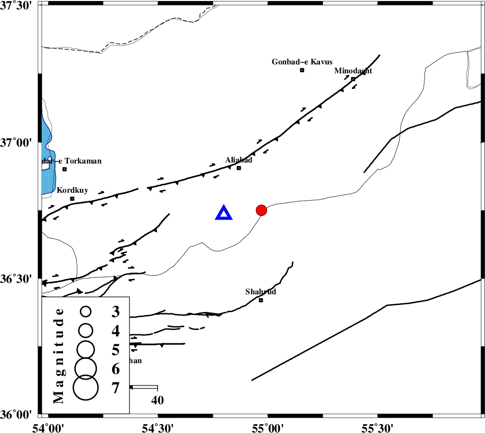
| Date & Time (UTC) | 2013-07-15 00:23:25.8 |
| Date & Time (Local) | 1392/4/24 04:53:25.8 |
| Location | Lat:36.75 Lon: 54.97 |
| Region | Golestan Province, 19 km South-East of Ali Abad |
Nearest Cities |
|
| 18 km North West of Qaleh-ye nokharqan, Semnan Province | |
| 19 km South East of Ali Abad, Golestan Province | |
| 29 km South of Khanbebin, Golestan Province | |
| 30 km North of Bastam, Semnan Province | |
| 32 km North West of Kalateh khanj, Semnan Province | |
| Depth | 18 km |
| Agency | |
Faults within 150 km: |
|
| SHAVAR_F (Length: 87 km) , Distance to epicenter: 11 km | |
| KHAZAR_F (Length: 523 km) , Distance to epicenter: 29 km | |
| ASTANEH_F (Length: 72 km) , Distance to epicenter: 44 km | |
| Number of Phases | 6 |
| RMS | 0.1 |
| Number of Stations | 6 |
| Error in Latitude | >3.2 km |
| Error in Longitude | 2.3 km |
| Error in Depth | 7.1 km |
Download waveform in seisan format
to download seisan software Click here
to access information about IIEES stations Click here
Amplitude | ||||||||
| UID | Agency | Station | Component | Amplitude | Period | Arrival Time | Proccessing Time | Signal Clip |
| 89897 | IIEES | MRVT | E | 366.6 | 0.4 | 2013-07-15 00:24:09 | 2013-07-15 03:45:00 | n |
| 89898 | IIEES | MRVT | N | 246.3 | 0.24 | 2013-07-15 00:24:09 | 2013-07-15 03:45:00 | n |
Phase | ||||||||||||
| Agency | Station | Component | Phase Type | Phase Quality | First Motion | Observed Arrival Time | Time Residual | Loc. Flag | Input Weight | Distance | Azimuth | |
| IIEES | BJRD | Z | Pn | E | 2013-07-15 00:24:03 | -0.1 | y | 241 | 63 | |||
| IIEES | BJRD | N | Sg | E | 2013-07-15 00:24:34 | 0.05 | y | 241 | 63 | |||
| IIEES | DAMV | Z | Pn | E | 2013-07-15 00:24:10 | -0.12 | y | 297 | 246 | |||
| IIEES | THKV | Z | Pn | E | 2013-07-15 00:24:20 | 0.17 | y | 379 | 257 | |||
| IIEES | TABS | Z | Pn | E | 2013-07-15 00:24:22 | -0.02 | y | 396 | 150 | |||
| IIEES | BSRN | Z | Pn | E | 2013-07-15 00:24:54 | 0.09 | y | 654 | 143 | |||