
Magnitude |
4.3 |
| Date & Time (UTC) | 2013-07-17 11:55:29.1 |
| Date & Time (Local) | 1392/4/26 16:25:29.1 |
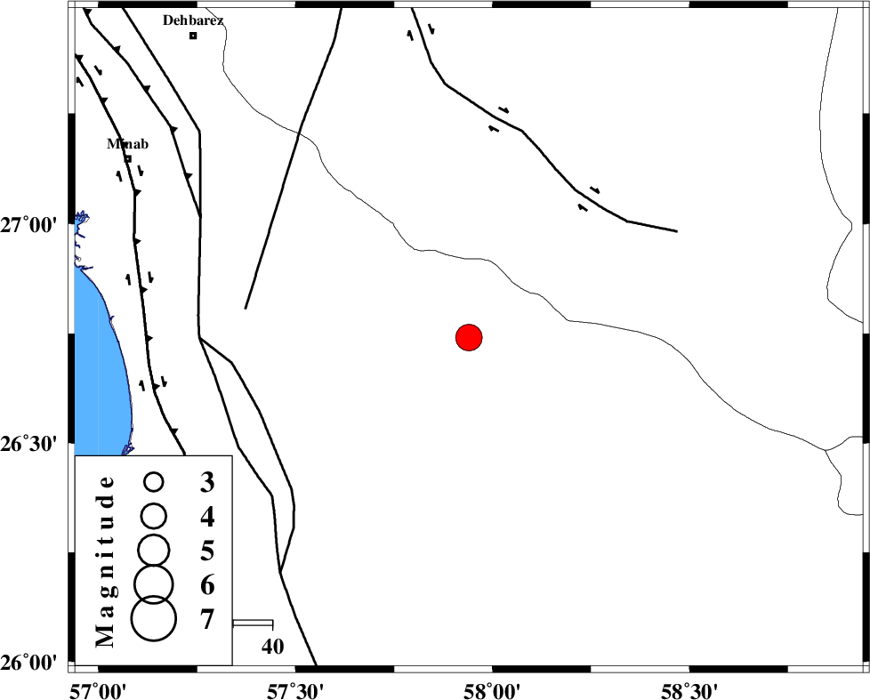
| Location | Lat:26.74 Lon: 57.94 |
| Region | Hormozgan Province, 86 km South-East of Manujan |
Nearest Cities |
|
| 16 km North of Angahran, Hormozgan Province | |
| 38 km North East of Darpahn, Hormozgan Province | |
| 41 km South of Keshmiran, Kerman Province | |
| 52 km East of Sanadrak, Hormozgan Province | |
| 76 km South East of Koryan, Hormozgan Province | |
| Depth | 17 km |
| Agency | |
Faults within 150 km: |
|
| JIROFT_F (Length: 144 km) , Distance to epicenter: 46 km | |
| ZENDAN_MINAB_F_Z2 (Length: 63 km) , Distance to epicenter: 56 km | |
| SABZEVARAN_F (Length: 190 km) , Distance to epicenter: 57 km | |
| Number of Phases | 8 |
| RMS | 0.1 |
| Number of Stations | 6 |
| Error in Latitude | >2.1 km |
| Error in Longitude | 2.4 km |
| Error in Depth | 3.1 km |
Download waveform in seisan format
to download seisan software Click here
to access information about IIEES stations Click here
Amplitude | ||||||||
| UID | Agency | Station | Component | Amplitude | Period | Arrival Time | Proccessing Time | Signal Clip |
| 89912 | IIEES | KRBR | E | 594.2 | 0.68 | 2013-07-17 11:57:27 | 2013-07-17 01:20:00 | n |
Phase | ||||||||||||
| Agency | Station | Component | Phase Type | Phase Quality | First Motion | Observed Arrival Time | Time Residual | Loc. Flag | Input Weight | Distance | Azimuth | |
| IIEES | CHBR | Z | Pn | E | 2013-07-17 11:56:11 | 0.14 | y | 284 | 116 | |||
| IIEES | CHBR | E | Sg | E | 2013-07-17 11:56:48 | -0.06 | y | 284 | 116 | |||
| IIEES | KRBR | N | Sg | E | 2013-07-17 11:57:14 | -0.01 | y | 377 | 342 | |||
| IIEES | ZHSF | Z | Pn | E | 2013-07-17 11:56:29 | 0.02 | y | 423 | 41 | |||
| IIEES | GHIR | Z | Pn | E | 2013-07-17 11:56:40 | -0.06 | y | 518 | 290 | |||
| IIEES | BSRN | Z | Pn | E | 2013-07-17 11:56:49 | -0.15 | y | 590 | 11 | |||
| IIEES | YZKH | Z | Pn | E | 2013-07-17 11:57:04 | -0.06 | y | 705 | 333 | |||
| IIEES | YZKH | N | Sg | E | 2013-07-17 11:58:45 | 0.14 | y | 705 | 333 | |||

 IIEES All Rights Reserved