
Magnitude |
3.6 |
| Date & Time (UTC) | 2013-07-19 23:26:42.1 |
| Date & Time (Local) | 1392/4/29 03:56:42.1 |
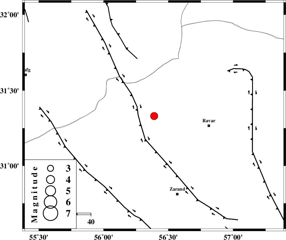
| Location | Lat:31.33 Lon: 56.39 |
| Region | Kerman Province, 41 km West of Ravar |
Nearest Cities |
|
| 11 km East of Jor, Kerman Province | |
| 13 km of Kuhbanan, Kerman Province | |
| 20 km North of Toghroljerd, Kerman Province | |
| 34 km North West of Dasht-e khak, Kerman Province | |
| 39 km North West of Dehali, Kerman Province | |
| Depth | 15 km |
| Agency | |
Faults within 150 km: |
|
| KUHBANAN_F (Length: 189 km) , Distance to epicenter: 12 km | |
| JAFARABAD_F (Length: 60 km) , Distance to epicenter: 44 km | |
| LAKARKUH_F (Length: 138 km) , Distance to epicenter: 63 km | |
| Number of Phases | 6 |
| RMS | 0.1 |
| Number of Stations | 4 |
| Error in Latitude | >2.8 km |
| Error in Longitude | 2.1 km |
| Error in Depth | 6.1 km |
Download waveform in seisan format
to download seisan software Click here
to access information about IIEES stations Click here
Amplitude | ||||||||
| UID | Agency | Station | Component | Amplitude | Period | Arrival Time | Proccessing Time | Signal Clip |
| 89939 | IIEES | YZKH | N | 486.9 | 0.4 | 2013-07-19 23:27:44 | 2013-07-20 12:49:00 | n |
| 89940 | IIEES | YZKH | E | 494.9 | 0.44 | 2013-07-19 23:27:45 | 2013-07-20 12:49:00 | n |
Phase | ||||||||||||
| Agency | Station | Component | Phase Type | Phase Quality | First Motion | Observed Arrival Time | Time Residual | Loc. Flag | Input Weight | Distance | Azimuth | |
| IIEES | YZKH | Z | Pn | E | 2013-07-19 23:27:15 | -0.05 | y | 207 | 305 | |||
| IIEES | TABS | Z | Pn | E | 2013-07-19 23:27:22 | -0.09 | y | 266 | 15 | |||
| IIEES | TABS | N | Sg | E | 2013-07-19 23:27:57 | 0.05 | y | 266 | 15 | |||
| IIEES | BSRN | Z | Pn | E | 2013-07-19 23:27:23 | 0.1 | y | 269 | 74 | |||
| IIEES | BSRN | N | Sg | E | 2013-07-19 23:27:57 | -0.05 | y | 269 | 74 | |||
| IIEES | NASN | Z | Pn | E | 2013-07-19 23:27:36 | 0.05 | y | 375 | 297 | |||