
Magnitude |
3.1 |
| Date & Time (UTC) | 2013-07-30 04:53:51.6 |
| Date & Time (Local) | 1392/5/8 09:23:51.6 |
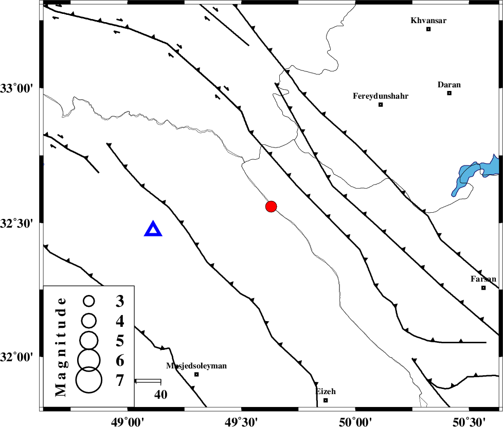
| Location | Lat:32.56 Lon: 49.63 |
| Region | Khoozestan Province, 47 km West of Chelgard |
Nearest Cities |
|
| 26 km South West of Durak, Chaharmahal Bakhtiari Province | |
| 31 km North of Paabshalal, Khoozestan Province | |
| 38 km South West of Masir, Esfahan Province | |
| 41 km South East of Parchal, Lorestan Province | |
| 43 km North East of Qale-yekhvaju, Khoozestan Province | |
| Depth | 18 km |
| Agency | |
Faults within 150 km: |
|
| ZARDKUH_F (Length: 139 km) , Distance to epicenter: 14 km | |
| ARDAL_F (Length: 170 km) , Distance to epicenter: 27 km | |
| HZF4 (Length: 492 km) , Distance to epicenter: 33 km | |
| Number of Phases | 5 |
| RMS | 0 |
| Number of Stations | 5 |
| Error in Latitude | >5.2 km |
| Error in Longitude | 3.7 km |
| Error in Depth | 10.4 km |
Download waveform in seisan format
to download seisan software Click here
to access information about IIEES stations Click here
Amplitude | ||||||||
| UID | Agency | Station | Component | Amplitude | Period | Arrival Time | Proccessing Time | Signal Clip |
| 90039 | IIEES | KHMZ | E | 530.9 | 0.4 | 2013-07-30 04:54:29 | 2013-07-30 06:18:00 | n |
| 90040 | IIEES | KHMZ | N | 309.7 | 0.52 | 2013-07-30 04:54:32 | 2013-07-30 06:18:00 | n |
| 90041 | IIEES | GHVR | N | 99.3 | 0.76 | 2013-07-30 04:55:09 | 2013-07-30 06:18:00 | n |
| 90042 | IIEES | GHVR | E | 91.5 | 0.48 | 2013-07-30 04:55:09 | 2013-07-30 06:18:00 | n |
Phase | ||||||||||||
| Agency | Station | Component | Phase Type | Phase Quality | First Motion | Observed Arrival Time | Time Residual | Loc. Flag | Input Weight | Distance | Azimuth | |
| IIEES | ASAO | Z | Pn | E | 2013-07-30 04:54:26 | -0.06 | y | 223 | 9 | |||
| IIEES | GHVR | Z | Pn | E | 2013-07-30 04:54:31 | -0.04 | y | 260 | 35 | |||
| IIEES | GHVR | N | Sg | E | 2013-07-30 04:55:05 | 0.03 | y | 260 | 35 | |||
| IIEES | NASN | Z | Pn | E | 2013-07-30 04:54:36 | 0.03 | y | 299 | 84 | |||
| IIEES | SNGE | Z | Pn | E | 2013-07-30 04:54:42 | 0.05 | y | 351 | 324 | |||