
Magnitude |
1.8 |
| Date & Time (UTC) | 2013-08-01 21:40:21.2 |
| Date & Time (Local) | 1392/5/11 02:10:21.2 |
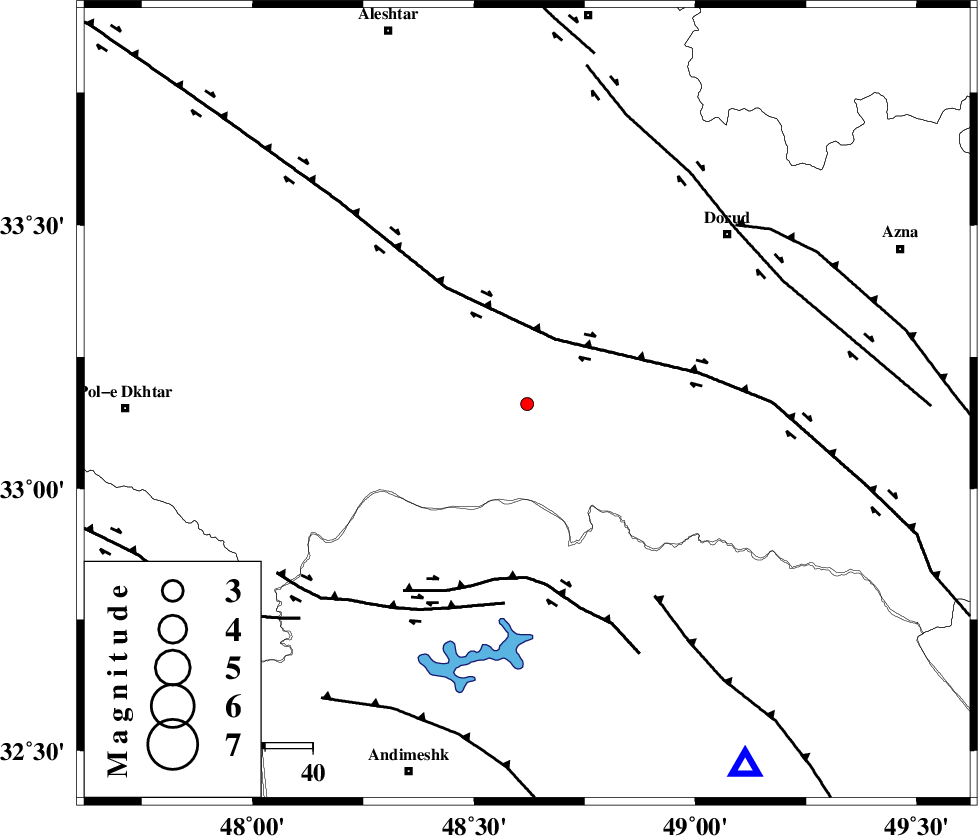
| Location | Lat:33.16 Lon: 48.62 |
| Region | Lorestan Province, 44 km South-East of Khorramabad |
Nearest Cities |
|
| 18 km West of Chamsangar, Lorestan Province | |
| 25 km South of Emanabad, Lorestan Province | |
| 32 km North West of Bargsar, Lorestan Province | |
| 34 km South West of Sartang barzeh, Lorestan Province | |
| 35 km South East of Daraei, Lorestan Province | |
| Depth | 14 km |
| Agency | |
Faults within 150 km: |
|
| HZF4 (Length: 492 km) , Distance to epicenter: 15 km | |
| BALARUD_F_Z2 (Length: 58 km) , Distance to epicenter: 37 km | |
| BALARUD_F_Z3 (Length: 53 km) , Distance to epicenter: 42 km | |
| Number of Phases | 5 |
| RMS | 0.2 |
| Number of Stations | 3 |
| Error in Latitude | >5 km |
| Error in Longitude | 4.8 km |
| Error in Depth | 8.6 km |
Download waveform in seisan format
to download seisan software Click here
to access information about IIEES stations Click here
Amplitude | ||||||||
| UID | Agency | Station | Component | Amplitude | Period | Arrival Time | Proccessing Time | Signal Clip |
| 90078 | IIEES | KHMZ | N | 9.7 | 0.44 | 2013-08-01 21:41:12 | 2013-08-02 12:04:00 | n |
| 90079 | IIEES | KHMZ | E | 13 | 0.64 | 2013-08-01 21:41:13 | 2013-08-02 12:04:00 | n |
| 90080 | IIEES | ASAO | E | 12.8 | 0.52 | 2013-08-01 21:41:22 | 2013-08-02 12:04:00 | n |
| 90081 | IIEES | SNGE | E | 9.3 | 0.36 | 2013-08-01 21:41:31 | 2013-08-02 12:04:00 | n |
| 90082 | IIEES | SNGE | N | 10.7 | 0.36 | 2013-08-01 21:41:32 | 2013-08-02 12:04:00 | n |
Phase | ||||||||||||
| Agency | Station | Component | Phase Type | Phase Quality | First Motion | Observed Arrival Time | Time Residual | Loc. Flag | Input Weight | Distance | Azimuth | |
| IIEES | KHMZ | Z | Pg | E | 2013-08-01 21:40:44 | -0.07 | y | 141 | 62 | |||
| IIEES | KHMZ | E | Sg | E | 2013-08-01 21:41:01 | -0.11 | y | 141 | 62 | |||
| IIEES | ASAO | Z | Pn | E | 2013-08-01 21:40:54 | 0.29 | y | 202 | 40 | |||
| IIEES | ASAO | E | Sg | E | 2013-08-01 21:41:18 | 0.03 | y | 202 | 40 | |||
| IIEES | SNGE | Z | Pn | E | 2013-08-01 21:40:59 | -0.14 | y | 245 | 332 | |||