
Magnitude |
1.9 |
| Date & Time (UTC) | 2013-08-01 22:52:24.1 |
| Date & Time (Local) | 1392/5/11 03:22:24.1 |
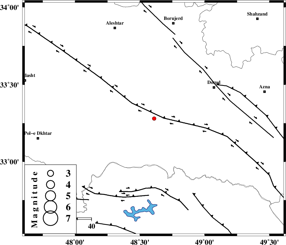
| Location | Lat:33.28 Lon: 48.61 |
| Region | Lorestan Province, 32 km South-East of Khorramabad |
Nearest Cities |
|
| 12 km South of Emanabad, Lorestan Province | |
| 21 km North West of Chamsangar, Lorestan Province | |
| 24 km South East of Kamalvand-e gholamali, Lorestan Province | |
| 26 km South of Zagheh, Lorestan Province | |
| 27 km South East of Daraei, Lorestan Province | |
| Depth | 17 km |
| Agency | |
Faults within 150 km: |
|
| HZF4 (Length: 492 km) , Distance to epicenter: 7 km | |
| DORUD (Length: 100 km) , Distance to epicenter: 50 km | |
| BALARUD_F_Z2 (Length: 58 km) , Distance to epicenter: 50 km | |
| Number of Phases | 5 |
| RMS | 0.1 |
| Number of Stations | 3 |
| Error in Latitude | >6.5 km |
| Error in Longitude | 3.4 km |
| Error in Depth | 5.7 km |
Download waveform in seisan format
to download seisan software Click here
to access information about IIEES stations Click here
Amplitude | ||||||||
| UID | Agency | Station | Component | Amplitude | Period | Arrival Time | Proccessing Time | Signal Clip |
| 90083 | IIEES | KHMZ | N | 14.1 | 0.4 | 2013-08-01 22:53:13 | 2013-08-02 03:53:00 | n |
| 90084 | IIEES | KHMZ | E | 16.3 | 0.6 | 2013-08-01 22:53:15 | 2013-08-02 03:53:00 | n |
| 90085 | IIEES | ASAO | E | 15.5 | 0.48 | 2013-08-01 22:53:24 | 2013-08-02 03:53:00 | n |
| 90086 | IIEES | SNGE | E | 11.4 | 0.36 | 2013-08-01 22:53:33 | 2013-08-02 03:53:00 | n |
| 90087 | IIEES | SNGE | N | 15.6 | 0.44 | 2013-08-01 22:53:34 | 2013-08-02 03:53:00 | n |
Phase | ||||||||||||
| Agency | Station | Component | Phase Type | Phase Quality | First Motion | Observed Arrival Time | Time Residual | Loc. Flag | Input Weight | Distance | Azimuth | |
| IIEES | KHMZ | Z | Pg | E | 2013-08-01 22:52:46 | -0.08 | y | 136 | 67 | |||
| IIEES | KHMZ | N | Sg | E | 2013-08-01 22:53:03 | 0.12 | y | 136 | 67 | |||
| IIEES | ASAO | Z | Pn | E | 2013-08-01 22:52:55 | -0.18 | y | 193 | 43 | |||
| IIEES | SNGE | Z | Pn | E | 2013-08-01 22:53:00 | 0.18 | y | 233 | 330 | |||
| IIEES | SNGE | E | Sg | E | 2013-08-01 22:53:30 | -0.05 | y | 233 | 330 | |||