
Magnitude |
3.8 |
| Date & Time (UTC) | 2013-08-03 13:21:36.6 |
| Date & Time (Local) | 1392/5/12 17:51:36.6 |
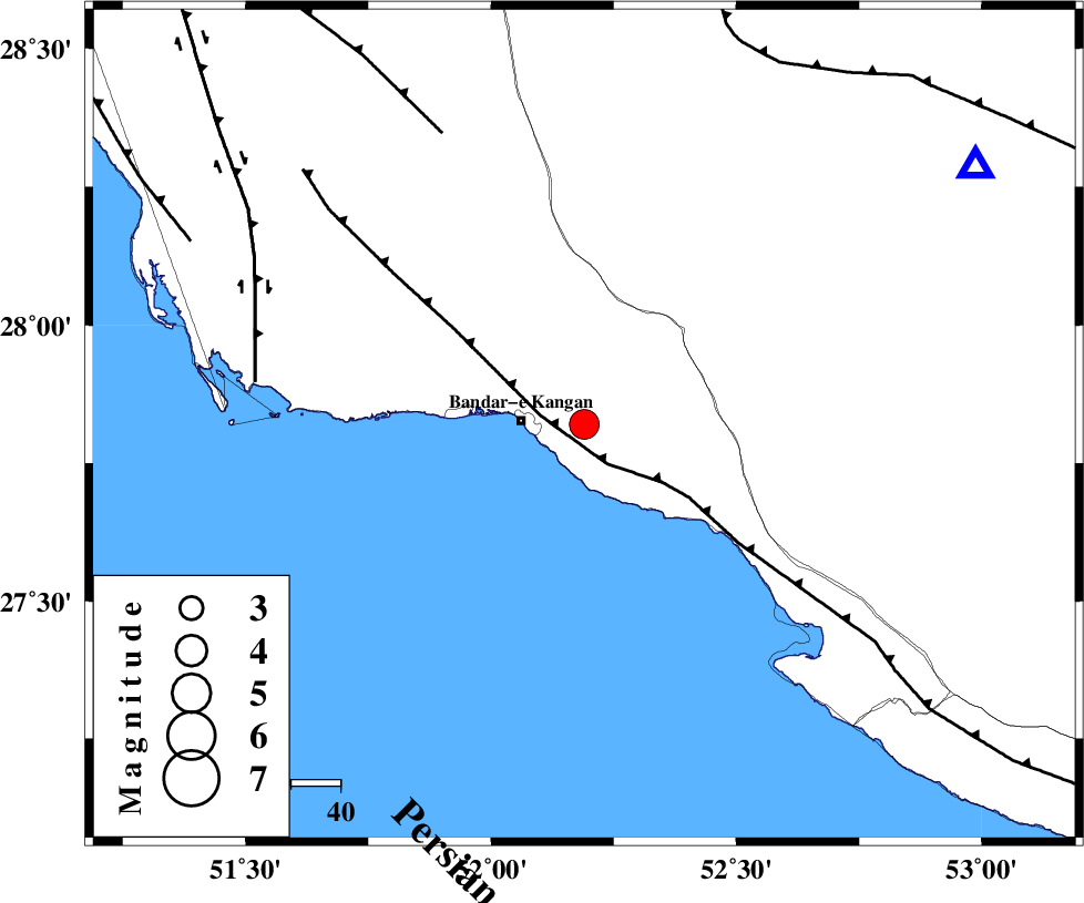
| Location | Lat:27.82 Lon: 52.19 |
| Region | Bushehr Province, 13 km East of Bandar-e kangan |
Nearest Cities |
|
| 12 km West of Jam, Bushehr Province | |
| 13 km East of Bandar-e kangan, Bushehr Province | |
| 23 km North West of Bandar-e taheri, Bushehr Province | |
| 28 km South East of Riz, Bushehr Province | |
| 38 km South West of Dolatabad, Fars Province | |
| Depth | 35 km |
| Agency | |
Faults within 150 km: |
|
| MFF3 (Length: 292 km) , Distance to epicenter: 9 km | |
| MFF5 (Length: 74 km) , Distance to epicenter: 65 km | |
| BORAZJAN_F (Length: 168 km) , Distance to epicenter: 66 km | |
| Number of Phases | 5 |
| RMS | 0.1 |
| Number of Stations | 4 |
| Error in Latitude | >7.7 km |
| Error in Longitude | 1.9 km |
| Error in Depth | 3.3 km |
Download waveform in seisan format
to download seisan software Click here
to access information about IIEES stations Click here
Amplitude | ||||||||
| UID | Agency | Station | Component | Amplitude | Period | Arrival Time | Proccessing Time | Signal Clip |
| 90099 | IIEES | AHRM | N | 1623 | 0.6 | 2013-08-03 13:22:29 | 2013-08-03 02:45:00 | n |
Phase | ||||||||||||
| Agency | Station | Component | Phase Type | Phase Quality | First Motion | Observed Arrival Time | Time Residual | Loc. Flag | Input Weight | Distance | Azimuth | |
| IIEES | GHIR | Z | Pg | E | 2013-08-03 13:21:52 | 0.06 | y | 93.4 | 57 | |||
| IIEES | GHIR | E | Sg | E | 2013-08-03 13:22:04 | -0.04 | y | 93.4 | 57 | |||
| IIEES | AHRM | Z | Pg | E | 2013-08-03 13:22:00 | -0.01 | y | 145 | 323 | |||
| IIEES | YZKH | Z | Pn | E | 2013-08-03 13:22:51 | 0.09 | y | 557 | 24 | |||
| IIEES | BSRN | Z | P | E | 2013-08-03 13:23:23 | -0.17 | y | 812 | 54 | |||