
Magnitude |
3.5 |
| Date & Time (UTC) | 2013-08-23 15:57:11.3 |
| Date & Time (Local) | 1392/6/1 20:27:11.3 |
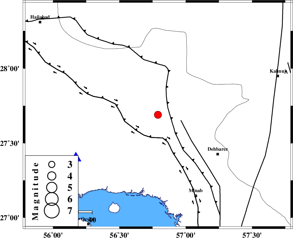
| Location | Lat:27.69 Lon: 56.79 |
| Region | Hormozgan Province, 53 km North-West of Dehbarez |
Nearest Cities |
|
| 43 km West of Ziaratali, Hormozgan Province | |
| 50 km North West of Balashahr, Hormozgan Province | |
| 50 km South West of Fariab, Hormozgan Province | |
| 53 km North West of Dehbarez, Hormozgan Province | |
| 63 km South West of Faryab, Kerman Province | |
| Depth | 14 km |
| Agency | |
Faults within 150 km: |
|
| MAIN_ZAGROS_R_F (Length: 1106 km) , Distance to epicenter: 9 km | |
| ZENDAN_MINAB_F_Z1 (Length: 183 km) , Distance to epicenter: 18 km | |
| HZF2 (Length: 437 km) , Distance to epicenter: 18 km | |
| Number of Phases | 4 |
| RMS | 0.1 |
| Number of Stations | 4 |
| Error in Latitude | >5.5 km |
| Error in Longitude | 6.8 km |
| Error in Depth | 4.2 km |
Download waveform in seisan format
to download seisan software Click here
to access information about IIEES stations Click here
Amplitude | ||||||||
| UID | Agency | Station | Component | Amplitude | Period | Arrival Time | Proccessing Time | Signal Clip |
| 90311 | IIEES | BNDS | N | 3049.7 | 0.48 | 2013-08-23 15:57:36 | 2013-08-23 05:27:00 | n |
| 90312 | IIEES | BNDS | E | 2177.4 | 0.32 | 2013-08-23 15:57:40 | 2013-08-23 05:27:00 | n |
| 90313 | IIEES | KRBR | N | 716.2 | 0.36 | 2013-08-23 15:58:18 | 2013-08-23 05:27:00 | n |
| 90314 | IIEES | GHIR | E | 58.1 | 0.64 | 2013-08-23 15:59:17 | 2013-08-23 05:27:00 | n |
Phase | ||||||||||||
| Agency | Station | Component | Phase Type | Phase Quality | First Motion | Observed Arrival Time | Time Residual | Loc. Flag | Input Weight | Distance | Azimuth | |
| IIEES | BNDS | Z | Pg | E | 2013-08-23 15:57:23 | -0.04 | y | 69.4 | 242 | |||
| IIEES | GHIR | Z | Pn | E | 2013-08-23 15:58:06 | 0.04 | y | 380 | 281 | |||
| IIEES | BSRN | Z | Pn | E | 2013-08-23 15:58:24 | 0.09 | y | 525 | 25 | |||
| IIEES | BSRN | E | Sg | E | 2013-08-23 15:59:37 | -0.07 | y | 525 | 25 | |||