
Magnitude |
3.3 |
| Date & Time (UTC) | 2013-08-26 12:40:50.9 |
| Date & Time (Local) | 1392/6/4 17:10:50.9 |
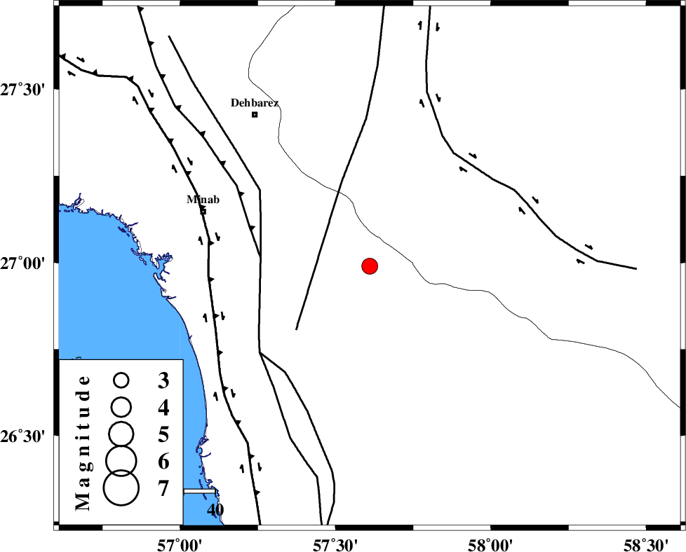
| Location | Lat:26.99 Lon: 57.61 |
| Region | Hormozgan Province, 48 km South-East of Manujan |
Nearest Cities |
|
| 25 km North East of Sanadrak, Hormozgan Province | |
| 33 km South West of Keshmiran, Kerman Province | |
| 38 km North of Darpahn, Hormozgan Province | |
| 39 km North East of Koryan, Hormozgan Province | |
| 48 km South East of Manujan, Kerman Province | |
| Depth | 14 km |
| Agency | |
Faults within 150 km: |
|
| SABZEVARAN_F (Length: 190 km) , Distance to epicenter: 28 km | |
| ZENDAN_MINAB_F_Z1 (Length: 183 km) , Distance to epicenter: 35 km | |
| MAIN_ZAGROS_R_F (Length: 1106 km) , Distance to epicenter: 35 km | |
| Number of Phases | 4 |
| RMS | 0.1 |
| Number of Stations | 3 |
| Error in Latitude | >4.4 km |
| Error in Longitude | 2.8 km |
| Error in Depth | 8.1 km |
Download waveform in seisan format
to download seisan software Click here
to access information about IIEES stations Click here
Amplitude | ||||||||
| UID | Agency | Station | Component | Amplitude | Period | Arrival Time | Proccessing Time | Signal Clip |
| 90358 | IIEES | BNDS | E | 516.1 | 0.36 | 2013-08-26 12:41:44 | 2013-08-26 02:17:00 | n |
| 90359 | IIEES | BNDS | N | 377.3 | 0.48 | 2013-08-26 12:41:51 | 2013-08-26 02:17:00 | n |
Phase | ||||||||||||
| Agency | Station | Component | Phase Type | Phase Quality | First Motion | Observed Arrival Time | Time Residual | Loc. Flag | Input Weight | Distance | Azimuth | |
| IIEES | BNDS | Z | Pg | E | 2013-08-26 12:41:15 | -0.04 | y | 149 | 288 | |||
| IIEES | CHBR | Z | Pn | E | 2013-08-26 12:41:39 | -0.06 | y | 326 | 118 | |||
| IIEES | ZHSF | Z | Pn | E | 2013-08-26 12:41:51 | 0.23 | y | 426 | 46 | |||
| IIEES | ZHSF | E | Sg | E | 2013-08-26 12:42:49 | -0.11 | y | 426 | 46 | |||