
Magnitude |
2.4 |
| Date & Time (UTC) | 2013-09-16 18:19:09.3 |
| Date & Time (Local) | 1392/6/25 22:49:09.3 |
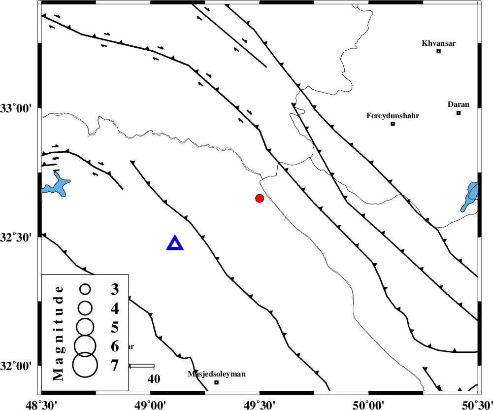
| Location | Lat:32.65 Lon: 49.5 |
| Region | Khoozestan Province, 47 km North-East of Lali |
Nearest Cities |
|
| 29 km South of Parchal, Lorestan Province | |
| 34 km West of Durak, Chaharmahal Bakhtiari Province | |
| 40 km South West of Masir, Esfahan Province | |
| 40 km North of Paabshalal, Khoozestan Province | |
| 47 km North East of Lali, Khoozestan Province | |
| Depth | 18 km |
| Agency | |
Faults within 150 km: |
|
| ZARDKUH_F (Length: 139 km) , Distance to epicenter: 22 km | |
| HZF4 (Length: 492 km) , Distance to epicenter: 22 km | |
| MFF2 (Length: 205 km) , Distance to epicenter: 30 km | |
| Number of Phases | 5 |
| RMS | 0.1 |
| Number of Stations | 4 |
| Error in Latitude | >5.5 km |
| Error in Longitude | 7.6 km |
| Error in Depth | 3.7 km |
Download waveform in seisan format
to download seisan software Click here
to access information about IIEES stations Click here
Amplitude | ||||||||
| UID | Agency | Station | Component | Amplitude | Period | Arrival Time | Proccessing Time | Signal Clip |
| 90564 | IIEES | SHGR | N | 138.3 | 0.16 | 2013-09-16 18:19:39 | 2013-09-16 07:47:00 | n |
Phase | ||||||||||||
| Agency | Station | Component | Phase Type | Phase Quality | First Motion | Observed Arrival Time | Time Residual | Loc. Flag | Input Weight | Distance | Azimuth | |
| IIEES | SHGR | Z | Pg | E | 2013-09-16 18:19:24 | 0.08 | y | 89 | 227 | |||
| IIEES | KHMZ | Z | Pg | E | 2013-09-16 18:19:30 | 0 | y | 128 | 20 | |||
| IIEES | ASAO | Z | Pn | E | 2013-09-16 18:19:43 | -0.04 | y | 216 | 13 | |||
| IIEES | GHVR | Z | Pn | E | 2013-09-16 18:19:48 | -0.19 | y | 260 | 38 | |||
| IIEES | GHVR | N | Sg | E | 2013-09-16 18:20:22 | 0.15 | y | 260 | 38 | |||