
Magnitude |
3.3 |
| Date & Time (UTC) | 2013-09-22 23:13:36.4 |
| Date & Time (Local) | 1392/7/1 02:43:36.4 |
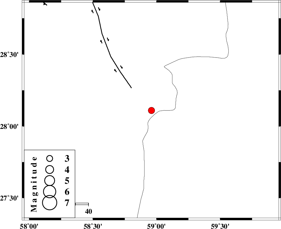
| Location | Lat:28.11 Lon: 58.96 |
| Region | Kerman Province, 125 km North-East of Kahnuj |
Nearest Cities |
|
| 45 km North East of Borj-e abbasabad, Kerman Province | |
| 67 km South West of Hoseynabad, Kerman Province | |
| 68 km South of Mohammadabad-e gonbaki, Kerman Province | |
| 81 km South East of Mardehak, Kerman Province | |
| 85 km South of Void, Kerman Province | |
| Depth | 18 km |
| Agency | |
Faults within 150 km: |
|
| BAM_F (Length: 118 km) , Distance to epicenter: 23 km | |
| KANURAK_F (Length: 135 km) , Distance to epicenter: 113 km | |
| GOWK_F (Length: 152 km) , Distance to epicenter: 114 km | |
| Number of Phases | 4 |
| RMS | 0 |
| Number of Stations | 3 |
| Error in Latitude | >9.3 km |
| Error in Longitude | 3.1 km |
| Error in Depth | 15.6 km |
Download waveform in seisan format
to download seisan software Click here
to access information about IIEES stations Click here
Amplitude | ||||||||
| UID | Agency | Station | Component | Amplitude | Period | Arrival Time | Proccessing Time | Signal Clip |
| 90603 | IIEES | BSRN | E | 47.6 | 0.36 | 2013-09-22 23:15:43 | 2013-09-23 01:55:00 | n |
| 90604 | IIEES | BSRN | N | 41.8 | 0.48 | 2013-09-22 23:15:50 | 2013-09-23 01:55:00 | n |
Phase | ||||||||||||
| Agency | Station | Component | Phase Type | Phase Quality | First Motion | Observed Arrival Time | Time Residual | Loc. Flag | Input Weight | Distance | Azimuth | |
| IIEES | ZHSF | Z | Pn | E | 2013-09-22 23:14:14 | 0.04 | y | 243 | 46 | |||
| IIEES | KRBR | Z | Pn | E | 2013-09-22 23:14:21 | -0.06 | y | 298 | 315 | |||
| IIEES | KRBR | E | Sg | E | 2013-09-22 23:15:00 | 0.04 | y | 298 | 315 | |||
| IIEES | BSRN | E | Sg | E | 2013-09-22 23:15:35 | -0.03 | y | 428 | 2 | |||