
Magnitude |
2.5 |
| Date & Time (UTC) | 2013-10-04 18:44:37.3 |
| Date & Time (Local) | 1392/7/12 22:14:37.3 |
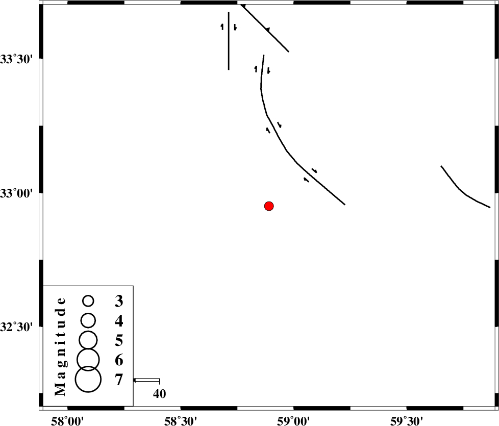
| Location | Lat:32.95 Lon: 58.89 |
| Region | Khorasan(south) Province, 33 km West of Birjand |
Nearest Cities |
|
| 20 km North of Khusef, Khorasan(south) Province | |
| 25 km North of Bisheh bala, Khorasan(south) Province | |
| 32 km North West of Birjand, Khorasan(south) Province | |
| 36 km South West of Konder, Khorasan(south) Province | |
| 39 km South of Musaviyeh, Khorasan(south) Province | |
| Depth | 15 km |
| Agency | |
Faults within 150 km: |
|
| MOHAMMADABAD_F (Length: 71 km) , Distance to epicenter: 21 km | |
| DUSTABAD_F (Length: 22 km) , Distance to epicenter: 59 km | |
| FERDOWS_F (Length: 101 km) , Distance to epicenter: 64 km | |
| Number of Phases | 4 |
| RMS | 0 |
| Number of Stations | 3 |
| Error in Latitude | >1.8 km |
| Error in Longitude | 2 km |
| Error in Depth | 8.6 km |
Download waveform in seisan format
to download seisan software Click here
to access information about IIEES stations Click here
Amplitude | ||||||||
| UID | Agency | Station | Component | Amplitude | Period | Arrival Time | Proccessing Time | Signal Clip |
| 90704 | IIEES | SHRT | N | 144.6 | 0.36 | 2013-10-04 18:45:23 | 2013-10-05 04:50:00 | n |
| 90705 | IIEES | SHRT | E | 116.9 | 0.64 | 2013-10-04 18:45:24 | 2013-10-05 04:50:00 | n |
| 90706 | IIEES | TABS | N | 57.4 | 0.68 | 2013-10-04 18:45:32 | 2013-10-05 04:50:00 | n |
| 90707 | IIEES | TABS | E | 25.8 | 0.52 | 2013-10-04 18:45:34 | 2013-10-05 04:50:00 | n |
Phase | ||||||||||||
| Agency | Station | Component | Phase Type | Phase Quality | First Motion | Observed Arrival Time | Time Residual | Loc. Flag | Input Weight | Distance | Azimuth | |
| IIEES | BSRN | Z | Pg | E | 2013-10-04 18:44:56 | 0 | y | 112 | 168 | |||
| IIEES | BSRN | N | S | E | 2013-10-04 18:45:09 | 0 | y | 112 | 168 | |||
| IIEES | SHRT | Z | Pg | E | 2013-10-04 18:45:02 | 0 | y | 152 | 59 | |||
| IIEES | TABS | Z | Pg | E | 2013-10-04 18:45:07 | 0 | y | 182 | 296 | |||