
Magnitude |
2.2 |
| Date & Time (UTC) | 2013-10-09 16:05:30.5 |
| Date & Time (Local) | 1392/7/17 19:35:30.5 |
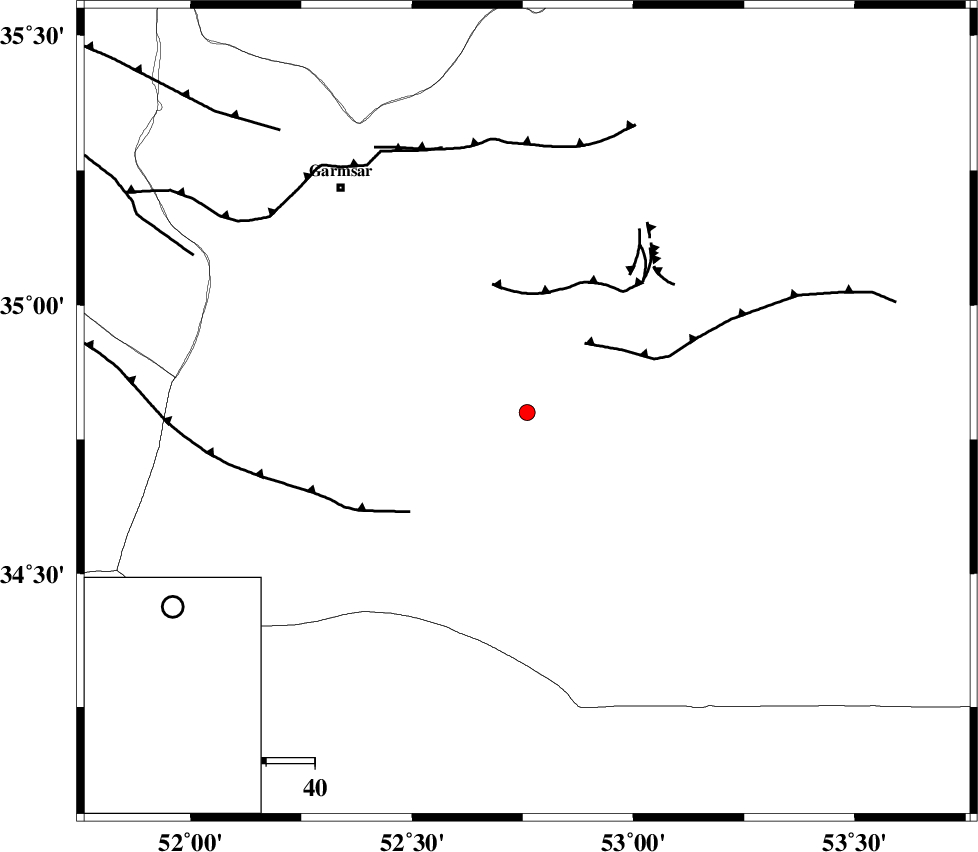
| Location | Lat:34.8 Lon: 52.76 |
| Region | Semnan Province, 60 km South-East of Garmsar |
Nearest Cities |
|
| 51 km South East of Kohanabad, Semnan Province | |
| 52 km South East of Gardovan, Semnan Province | |
| 53 km South East of Davarabad, Semnan Province | |
| 54 km South East of Aradan, Semnan Province | |
| 59 km South East of Lajran, Semnan Province | |
| Depth | 14 km |
| Agency | |
Faults within 150 km: |
|
| KUH_E_GUGERD_F (Length: 73 km) , Distance to epicenter: 19 km | |
| KUH_E_GACHAB_F1 (Length: 53 km) , Distance to epicenter: 26 km | |
| SIAHKUH_F (Length: 154 km) , Distance to epicenter: 30 km | |
| Number of Phases | 4 |
| RMS | 0.1 |
| Number of Stations | 3 |
| Error in Latitude | >2 km |
| Error in Longitude | 8.2 km |
| Error in Depth | 4.8 km |
Download waveform in seisan format
to download seisan software Click here
to access information about IIEES stations Click here
Amplitude | ||||||||
| UID | Agency | Station | Component | Amplitude | Period | Arrival Time | Proccessing Time | Signal Clip |
| 90756 | IIEES | GHVR | E | 40.4 | 0.4 | 2013-10-09 16:06:14 | 2013-10-09 06:31:00 | n |
Phase | ||||||||||||
| Agency | Station | Component | Phase Type | Phase Quality | First Motion | Observed Arrival Time | Time Residual | Loc. Flag | Input Weight | Distance | Azimuth | |
| IIEES | DAMV | Z | Pg | E | 2013-10-09 16:05:50 | -0.04 | y | 117 | 322 | |||
| IIEES | DAMV | E | Sg | E | 2013-10-09 16:06:04 | 0.02 | y | 117 | 322 | |||
| IIEES | GHVR | Z | Pg | E | 2013-10-09 16:05:54 | -0.06 | y | 143 | 256 | |||
| IIEES | ASAO | Z | Pn | E | 2013-10-09 16:06:09 | 0.08 | y | 252 | 264 | |||