
Magnitude |
3.9 |
| Date & Time (UTC) | 2013-10-13 22:21:54.7 |
| Date & Time (Local) | 1392/7/22 01:51:54.7 |
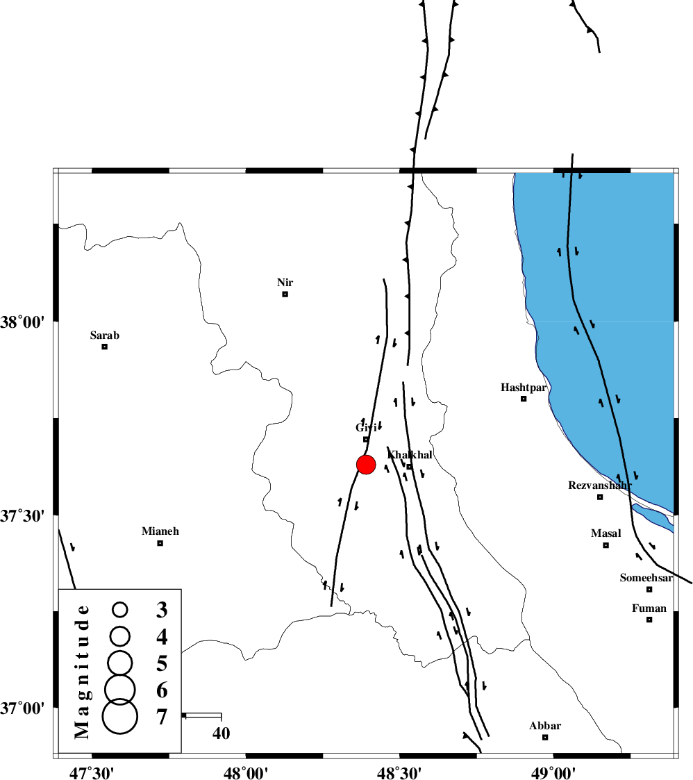
| Location | Lat:37.63 Lon: 48.39 |
| Region | Ardebil Province, 7 km Givi |
Nearest Cities |
|
| 7 km North of Gazaz, Ardebil Province | |
| 7 km of Givi, Ardebil Province | |
| 12 km North West of Khalkhal, Ardebil Province | |
| 13 km North East of Firuz Abad, Ardebil Province | |
| 14 km East of Ganjgah, Ardebil Province | |
| Depth | 14 km |
| Agency | |
Faults within 150 km: |
|
| MASULEL_F (Length: 90 km) , Distance to epicenter: 5 km | |
| SANGAVAR_F (Length: 61 km) , Distance to epicenter: 8 km | |
| BOZQUSH (Length: 70 km) , Distance to epicenter: 45 km | |
| Number of Phases | 5 |
| RMS | 0 |
| Number of Stations | 3 |
| Error in Latitude | >1.8 km |
| Error in Longitude | 3.4 km |
| Error in Depth | 4.8 km |
Download waveform in seisan format
to download seisan software Click here
to access information about IIEES stations Click here
Amplitude | ||||||||
| UID | Agency | Station | Component | Amplitude | Period | Arrival Time | Proccessing Time | Signal Clip |
| 90777 | IIEES | GRMI | N | 1322.3 | 0.28 | 2013-10-13 22:22:37 | 2013-10-14 04:38:00 | n |
| 90778 | IIEES | GRMI | E | 3899.7 | 0.28 | 2013-10-13 22:22:38 | 2013-10-14 04:38:00 | n |
Phase | ||||||||||||
| Agency | Station | Component | Phase Type | Phase Quality | First Motion | Observed Arrival Time | Time Residual | Loc. Flag | Input Weight | Distance | Azimuth | |
| IIEES | ZNJK | Z | Pg | E | 2013-10-13 22:22:13 | 0.04 | y | 110 | 166 | |||
| IIEES | ZNJK | E | Sg | E | 2013-10-13 22:22:27 | -0.03 | y | 110 | 166 | |||
| IIEES | GRMI | Z | P | E | 2013-10-13 22:22:17 | -0.05 | y | 138 | 342 | |||
| IIEES | MAKU | Z | Pn | E | 2013-10-13 22:22:49 | 0.08 | y | 376 | 302 | |||
| IIEES | MAKU | N | Sg | E | 2013-10-13 22:23:39 | -0.02 | y | 376 | 302 | |||