
Magnitude |
2 |
| Date & Time (UTC) | 2013-10-19 19:37:46.8 |
| Date & Time (Local) | 1392/7/27 23:07:46.8 |
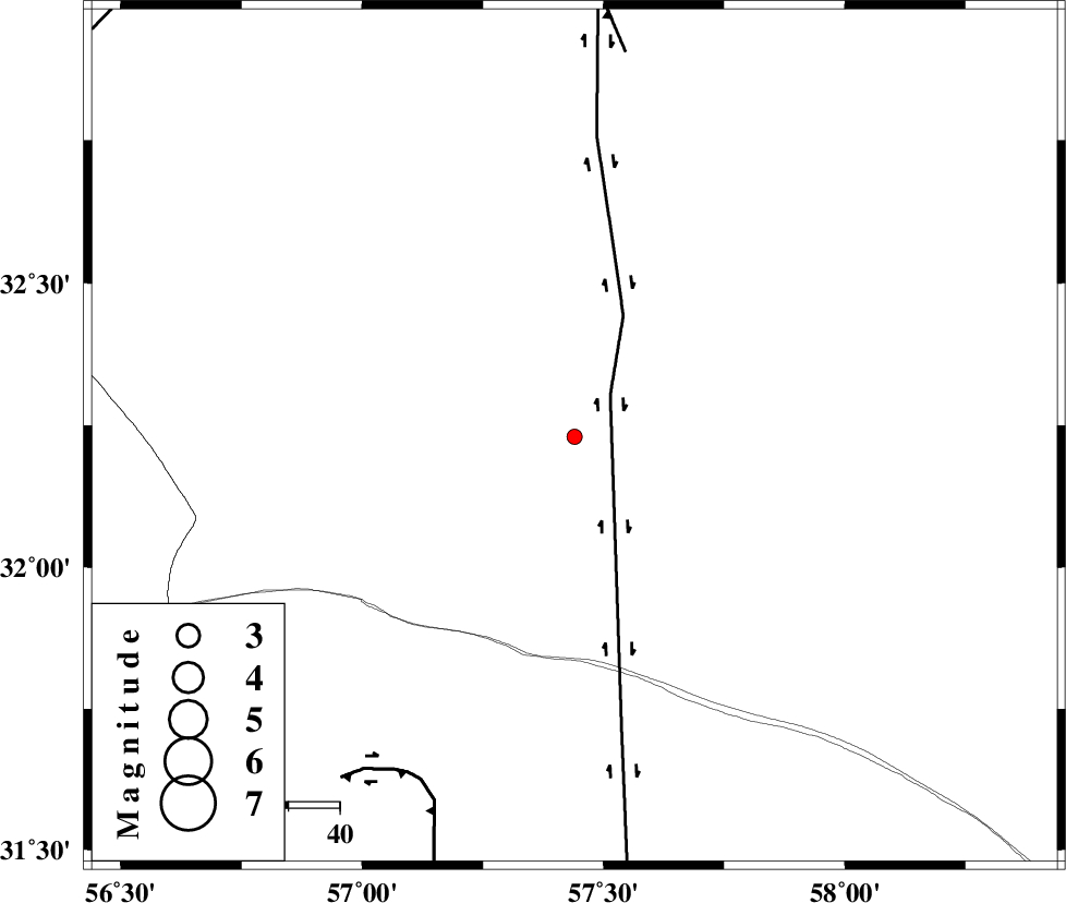
| Location | Lat:32.23 Lon: 57.44 |
| Region | Yazd Province, 123 km North-East of Ravar |
Nearest Cities |
|
| 8 km North of Hoz-e qorban, Yazd Province | |
| 96 km South West of Arababad, Yazd Province | |
| 118 km North East of Dehali, Kerman Province | |
| 118 km South of Dihuk, Yazd Province | |
| 123 km North East of Ravar, Kerman Province | |
| Depth | 15 km |
| Agency | |
Faults within 150 km: |
|
| NAYBAND_F (Length: 258 km) , Distance to epicenter: 11 km | |
| LAKARKUH_F (Length: 138 km) , Distance to epicenter: 73 km | |
| ESFARDIAR_F (Length: 94 km) , Distance to epicenter: 76 km | |
| Number of Phases | 3 |
| RMS | 0 |
| Number of Stations | 3 |
| Error in Latitude | >2.3 km |
| Error in Longitude | 1.9 km |
| Error in Depth | 0 km |
Download waveform in seisan format
to download seisan software Click here
to access information about IIEES stations Click here
Amplitude | ||||||||
| UID | Agency | Station | Component | Amplitude | Period | Arrival Time | Proccessing Time | Signal Clip |
| 90824 | IIEES | BSRN | N | 14.7 | 0.32 | 2013-10-19 19:38:38 | 2013-10-20 04:33:00 | n |
| 90825 | IIEES | YZKH | N | 8.7 | 0.48 | 2013-10-19 19:39:01 | 2013-10-20 04:33:00 | n |
| 90826 | IIEES | YZKH | E | 10.1 | 0.32 | 2013-10-19 19:39:02 | 2013-10-20 04:33:00 | n |
Phase | ||||||||||||
| Agency | Station | Component | Phase Type | Phase Quality | First Motion | Observed Arrival Time | Time Residual | Loc. Flag | Input Weight | Distance | Azimuth | |
| IIEES | TABS | Z | Pg | E | 2013-10-19 19:38:13 | 0 | y | 160 | 349 | |||
| IIEES | BSRN | Z | Pg | E | 2013-10-19 19:38:13 | 0 | y | 162 | 100 | |||
| IIEES | YZKH | Z | Pn | E | 2013-10-19 19:38:28 | 0 | y | 269 | 274 | |||