
Magnitude |
2.1 |
| Date & Time (UTC) | 2013-10-27 19:21:54.6 |
| Date & Time (Local) | 1392/8/5 22:51:54.6 |
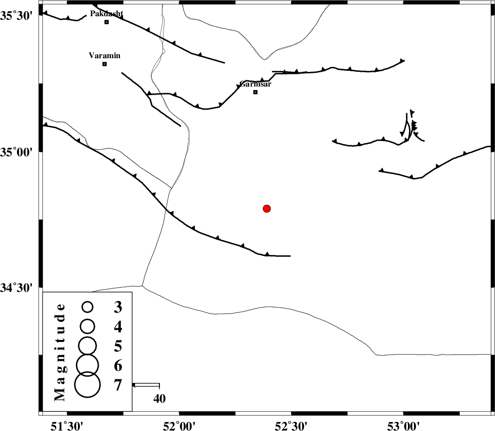
| Location | Lat:34.79 Lon: 52.39 |
| Region | Semnan Province, 48 km South of Garmsar |
Nearest Cities |
|
| 42 km South of Gardovan, Semnan Province | |
| 45 km South of Lajran, Semnan Province | |
| 48 km South of Garmsar, Semnan Province | |
| 48 km South of Davarabad, Semnan Province | |
| 51 km South West of Kohanabad, Semnan Province | |
| Depth | 18 km |
| Agency | |
Faults within 150 km: |
|
| SIAHKUH_F (Length: 154 km) , Distance to epicenter: 18 km | |
| KUH_E_GACHAB_F1 (Length: 53 km) , Distance to epicenter: 38 km | |
| GARMSAR_F (Length: 77 km) , Distance to epicenter: 46 km | |
| Number of Phases | 7 |
| RMS | 0.1 |
| Number of Stations | 4 |
| Error in Latitude | >1.6 km |
| Error in Longitude | 3.7 km |
| Error in Depth | 4.4 km |
Download waveform in seisan format
to download seisan software Click here
to access information about IIEES stations Click here
Amplitude | ||||||||
| UID | Agency | Station | Component | Amplitude | Period | Arrival Time | Proccessing Time | Signal Clip |
| 90871 | IIEES | DAMV | E | 55.1 | 0.12 | 2013-10-27 19:22:27 | 2013-10-28 04:08:00 | n |
Phase | ||||||||||||
| Agency | Station | Component | Phase Type | Phase Quality | First Motion | Observed Arrival Time | Time Residual | Loc. Flag | Input Weight | Distance | Azimuth | |
| IIEES | DAMV | Z | Pg | E | 2013-10-27 19:22:11 | 0.07 | y | 100 | 338 | |||
| IIEES | DAMV | E | Sg | E | 2013-10-27 19:22:24 | 0.15 | y | 100 | 338 | |||
| IIEES | GHVR | Z | Pg | E | 2013-10-27 19:22:13 | -0.04 | y | 110 | 252 | |||
| IIEES | GHVR | E | Sg | E | 2013-10-27 19:22:26 | 0.08 | y | 110 | 252 | |||
| IIEES | CHTH | Z | Pg | E | 2013-10-27 19:22:22 | -0.18 | y | 169 | 318 | |||
| IIEES | CHTH | E | Sg | E | 2013-10-27 19:22:43 | -0.1 | y | 169 | 318 | |||
| IIEES | ASAO | Z | Pn | E | 2013-10-27 19:22:29 | 0.02 | y | 218 | 264 | |||