
Magnitude |
2.3 |
| Date & Time (UTC) | 2013-10-29 04:55:51.7 |
| Date & Time (Local) | 1392/8/7 08:25:51.7 |
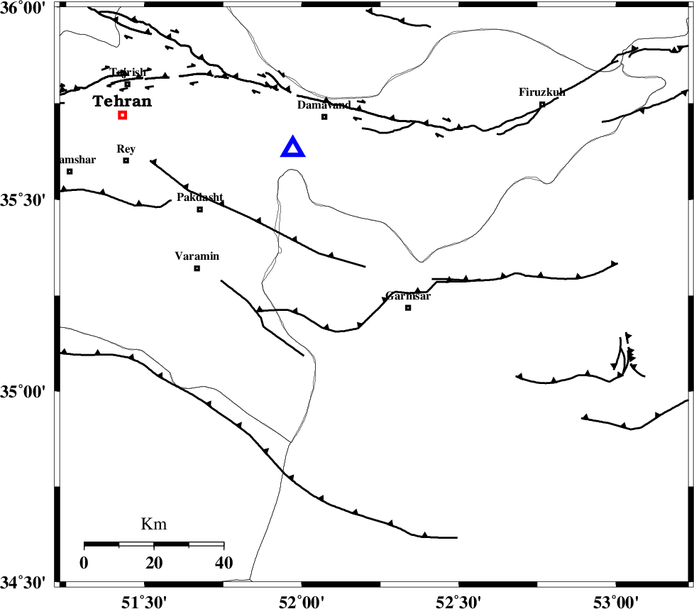
| Location | Lat:35.25 Lon: 52.23 |
| Region | Semnan Province, 10 km West of Garmsar |
Nearest Cities |
|
| 11 km North West of Garmsar, Semnan Province | |
| 11 km North of Lajran, Semnan Province | |
| 18 km East of Evanekay, Semnan Province | |
| 19 km North West of Gardovan, Semnan Province | |
| 22 km North West of Davarabad, Semnan Province | |
| Depth | 18 km |
| Agency | |
Faults within 150 km: |
|
| GARMSAR_F (Length: 77 km) , Distance to epicenter: 4 km | |
| EYVANEKEY_F (Length: 74 km) , Distance to epicenter: 9 km | |
| PISHAV_F (Length: 34 km) , Distance to epicenter: 27 km | |
| Number of Phases | 6 |
| RMS | 0.1 |
| Number of Stations | 4 |
| Error in Latitude | >1.3 km |
| Error in Longitude | 4.1 km |
| Error in Depth | 4.1 km |
Download waveform in seisan format
to download seisan software Click here
to access information about IIEES stations Click here
Amplitude | ||||||||
| UID | Agency | Station | Component | Amplitude | Period | Arrival Time | Proccessing Time | Signal Clip |
| 90879 | IIEES | ASAO | E | 22.2 | 0.48 | 2013-10-29 04:56:52 | 2013-10-29 05:16:00 | n |
Phase | ||||||||||||
| Agency | Station | Component | Phase Type | Phase Quality | First Motion | Observed Arrival Time | Time Residual | Loc. Flag | Input Weight | Distance | Azimuth | |
| IIEES | DAMV | Z | Pg | E | 2013-10-29 04:56:00 | 0.15 | y | 48.4 | 331 | |||
| IIEES | GHVR | Z | Pg | E | 2013-10-29 04:56:12 | -0.16 | y | 124 | 227 | |||
| IIEES | CHTH | Z | Pg | E | 2013-10-29 04:56:12 | -0.13 | y | 124 | 306 | |||
| IIEES | CHTH | N | Sg | E | 2013-10-29 04:56:27 | -0.02 | y | 124 | 306 | |||
| IIEES | GHVR | N | Sg | E | 2013-10-29 04:56:27 | 0.12 | y | 124 | 227 | |||
| IIEES | ASAO | Z | Pn | E | 2013-10-29 04:56:26 | 0.04 | y | 216 | 250 | |||