
Magnitude |
3.5 |
| Date & Time (UTC) | 2013-11-02 11:20:01.0 |
| Date & Time (Local) | 1392/8/11 14:50:01.0 |
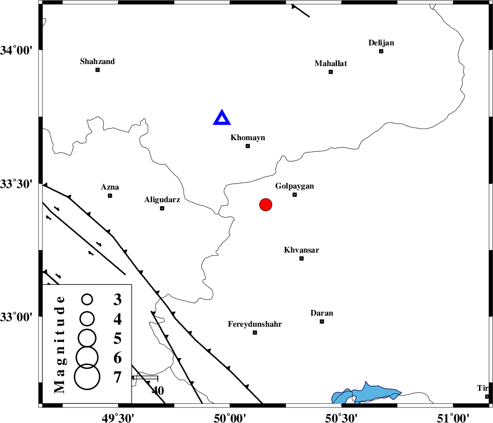
| Location | Lat:33.42 Lon: 50.16 |
| Region | Esfahan Province, 13 km West of Golpayegan |
Nearest Cities |
|
| 9 km North of Veyst, Esfahan Province | |
| 13 km West of Golpayegan, Esfahan Province | |
| 18 km North of Sardsir, Esfahan Province | |
| 19 km West of Gogad, Esfahan Province | |
| 19 km North East of Halaghareh, Lorestan Province | |
| Depth | 14 km |
| Agency | |
Faults within 150 km: |
|
| MAIN_ZAGROS_R_F (Length: 1106 km) , Distance to epicenter: 59 km | |
| ARDAL_F (Length: 170 km) , Distance to epicenter: 65 km | |
| DORUD (Length: 100 km) , Distance to epicenter: 65 km | |
| Number of Phases | 4 |
| RMS | 0 |
| Number of Stations | 3 |
| Error in Latitude | >6.6 km |
| Error in Longitude | 3 km |
| Error in Depth | 12 km |
Download waveform in seisan format
to download seisan software Click here
to access information about IIEES stations Click here
Amplitude | ||||||||
| UID | Agency | Station | Component | Amplitude | Period | Arrival Time | Proccessing Time | Signal Clip |
| 90899 | IIEES | KHMZ | E | 4734.9 | 0.56 | 2013-11-02 11:20:14 | 2013-11-02 12:42:00 | n |
Phase | ||||||||||||
| Agency | Station | Component | Phase Type | Phase Quality | First Motion | Observed Arrival Time | Time Residual | Loc. Flag | Input Weight | Distance | Azimuth | |
| IIEES | KHMZ | Z | Pg | E | 2013-11-02 11:20:08 | 0.01 | y | 39.3 | 333 | |||
| IIEES | GHVR | Z | Pg | E | 2013-11-02 11:20:26 | -0.05 | y | 155 | 40 | |||
| IIEES | GHVR | N | Sg | E | 2013-11-02 11:20:45 | 0.02 | y | 155 | 40 | |||
| IIEES | TABS | Z | Pn | E | 2013-11-02 11:21:29 | 0.03 | y | 647 | 86 | |||