
Magnitude |
2.7 |
| Date & Time (UTC) | 2013-12-11 05:27:11.3 |
| Date & Time (Local) | 1392/9/20 08:57:11.3 |
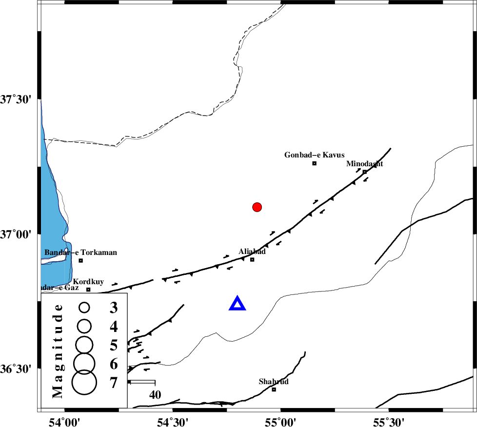
| Location | Lat:37.1 Lon: 54.89 |
| Region | Golestan Province, 22 km North of Ali Abad |
Nearest Cities |
|
| 13 km North of Khanbebin, Golestan Province | |
| 14 km North East of Gariduji, Golestan Province | |
| 16 km West of Baghli marma, Golestan Province | |
| 17 km North West of Deland, Golestan Province | |
| 22 km North of Ali Abad, Golestan Province | |
| Depth | 14 km |
| Agency | |
Faults within 150 km: |
|
| KHAZAR_F (Length: 523 km) , Distance to epicenter: 12 km | |
| SHAVAR_F (Length: 87 km) , Distance to epicenter: 45 km | |
| ROBATE_QARABIL_F (Length: 168 km) , Distance to epicenter: 54 km | |
| Number of Phases | 5 |
| RMS | 0.2 |
| Number of Stations | 4 |
| Error in Latitude | >6.9 km |
| Error in Longitude | 2.2 km |
| Error in Depth | 7.6 km |
Download waveform in seisan format
to download seisan software Click here
to access information about IIEES stations Click here
Amplitude | ||||||||
| UID | Agency | Station | Component | Amplitude | Period | Arrival Time | Proccessing Time | Signal Clip |
| 91192 | IIEES | DAMV | E | 26.3 | 0.32 | 2013-12-11 05:28:41 | 2013-12-11 06:50:00 | n |
Phase | ||||||||||||
| Agency | Station | Component | Phase Type | Phase Quality | First Motion | Observed Arrival Time | Time Residual | Loc. Flag | Input Weight | Distance | Azimuth | |
| IIEES | SHRO | E | Pg | E | 2013-12-11 05:27:37 | -0.04 | y | 158 | 140 | |||
| IIEES | BJRD | Z | Pn | E | 2013-12-11 05:27:48 | -0.03 | y | 233 | 73 | |||
| IIEES | DAMV | Z | Pn | E | 2013-12-11 05:27:57 | 0.31 | y | 308 | 239 | |||
| IIEES | CHTH | Z | Pn | E | 2013-12-11 05:28:04 | -0.14 | y | 362 | 250 | |||
| IIEES | CHTH | N | Sg | E | 2013-12-11 05:28:52 | -0.11 | y | 362 | 250 | |||