
Magnitude |
4.2 |
| Date & Time (UTC) | 2014-01-02 10:50:18.6 |
| Date & Time (Local) | 1392/10/12 14:20:18.6 |
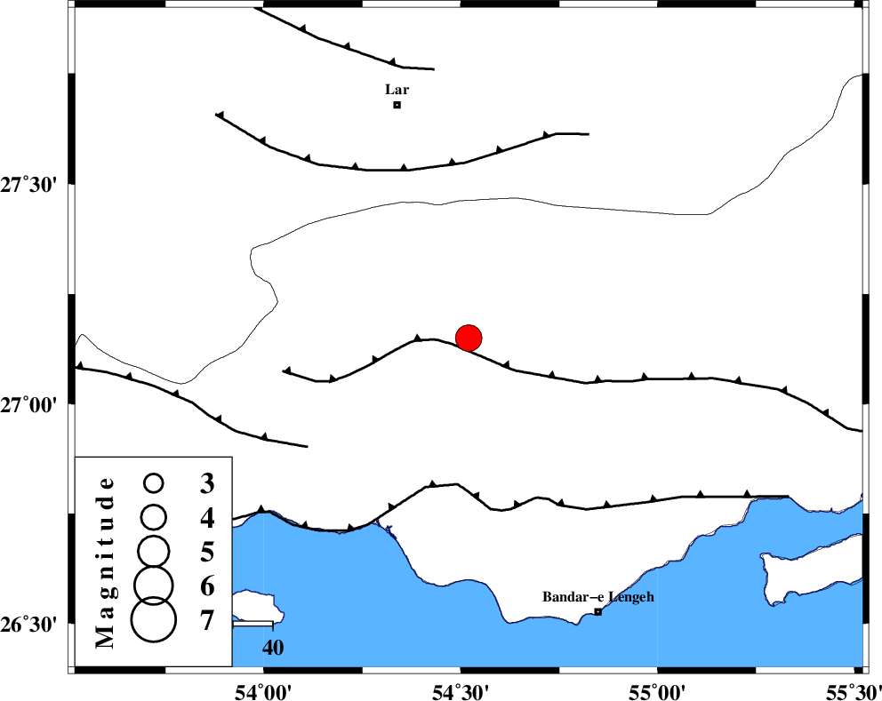
| Location | Lat:27.15 Lon: 54.52 |
| Region | Hormozgan Province, 16 km East of Bastak |
Nearest Cities |
|
| 16 km East of Bastak, Hormozgan Province | |
| 28 km North East of Jenah, Hormozgan Province | |
| 61 km South East of Lar, Fars Province | |
| 62 km South East of Bagh, Fars Province | |
| 63 km South East of Latifi, Fars Province | |
| Depth | 18 km |
| Agency | |
Faults within 150 km: |
|
| MFF1 (Length: 180 km) , Distance to epicenter: 4 km | |
| ZFF1 (Length: 165 km) , Distance to epicenter: 37 km | |
| LAR_F (Length: 99 km) , Distance to epicenter: 44 km | |
| Number of Phases | 6 |
| RMS | 0.1 |
| Number of Stations | 5 |
| Error in Latitude | >3.5 km |
| Error in Longitude | 1.4 km |
| Error in Depth | 5.3 km |
Download waveform in seisan format
to download seisan software Click here
to access information about IIEES stations Click here
Amplitude | ||||||||
| UID | Agency | Station | Component | Amplitude | Period | Arrival Time | Proccessing Time | Signal Clip |
| 91359 | IIEES | KRBR | N | 458.6 | 0.56 | 2014-01-02 10:52:02 | 2014-01-02 11:31:00 | n |
Phase | ||||||||||||
| Agency | Station | Component | Phase Type | Phase Quality | First Motion | Observed Arrival Time | Time Residual | Loc. Flag | Input Weight | Distance | Azimuth | |
| IIEES | AHRM | Z | Pn | E | 2014-01-02 10:51:11 | 0.04 | y | 369 | 302 | |||
| IIEES | AHRM | N | Sg | E | 2014-01-02 10:52:01 | -0.02 | y | 369 | 302 | |||
| IIEES | YZKH | Z | Pn | E | 2014-01-02 10:51:38 | 0 | y | 581 | 1 | |||
| IIEES | CHBR | Z | Pn | E | 2014-01-02 10:51:42 | 0.06 | y | 620 | 105 | |||
| IIEES | BSRN | Z | Pn | E | 2014-01-02 10:51:52 | -0.19 | y | 696 | 39 | |||
| IIEES | BSRN | E | Sg | E | 2014-01-02 10:53:31 | 0.07 | y | 696 | 39 | |||