
Magnitude |
1.7 |
| Date & Time (UTC) | 2014-01-19 11:26:34.9 |
| Date & Time (Local) | 1392/10/29 14:56:34.9 |
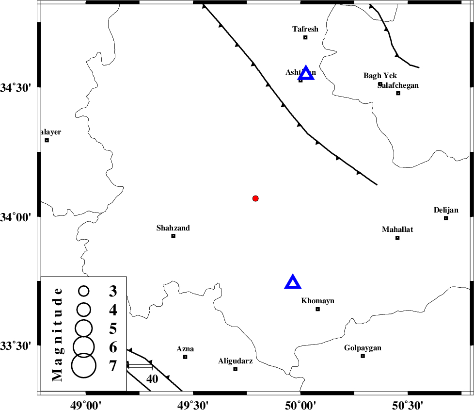
| Location | Lat:34.07 Lon: 49.79 |
| Region | Markazi Province, 10 km East of Arak |
Nearest Cities |
|
| 10 km East of Arak, Markazi Province | |
| 15 km East of Marzijaran, Markazi Province | |
| 16 km North West of Amanabad, Markazi Province | |
| 19 km North of Qasemabad, Markazi Province | |
| 20 km North East of Sanjan, Markazi Province | |
| Depth | 15 km |
| Agency | |
Faults within 150 km: |
|
| TAFRESH_F (Length: 117 km) , Distance to epicenter: 36 km | |
| MAIN_ZAGROS_R_F (Length: 1106 km) , Distance to epicenter: 84 km | |
| INDES_F (Length: 98 km) , Distance to epicenter: 86 km | |
| Number of Phases | 3 |
| RMS | 0 |
| Number of Stations | 3 |
| Error in Latitude | >1.4 km |
| Error in Longitude | 2.6 km |
| Error in Depth | 0 km |
Download waveform in seisan format
to download seisan software Click here
to access information about IIEES stations Click here
Amplitude | ||||||||
| UID | Agency | Station | Component | Amplitude | Period | Arrival Time | Proccessing Time | Signal Clip |
| 91546 | IIEES | KHMZ | E | 64.8 | 0.32 | 2014-01-19 11:26:49 | 2014-01-19 11:54:00 | n |
| 91547 | IIEES | SNGE | N | 6.6 | 0.4 | 2014-01-19 11:27:47 | 2014-01-19 11:54:00 | n |
Phase | ||||||||||||
| Agency | Station | Component | Phase Type | Phase Quality | First Motion | Observed Arrival Time | Time Residual | Loc. Flag | Input Weight | Distance | Azimuth | |
| IIEES | KHMZ | Z | Pg | E | 2014-01-19 11:26:42 | 0 | y | 40.1 | 157 | |||
| IIEES | ASAO | Z | Pg | E | 2014-01-19 11:26:45 | 0 | y | 56.9 | 22 | |||
| IIEES | SNGE | Z | Pn | E | 2014-01-19 11:27:13 | 0 | y | 251 | 297 | |||