
Magnitude |
2.9 |
| Date & Time (UTC) | 2014-01-21 04:56:25.1 |
| Date & Time (Local) | 1392/11/1 08:26:25.1 |
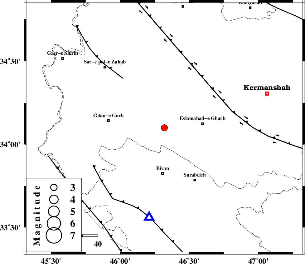
| Location | Lat:34.1 Lon: 46.32 |
| Region | Kermanshah Province, 31 km North of Eyvan |
Nearest Cities |
|
| 10 km of Khosroabad, Kermanshah Province | |
| 11 km North of Sarmast, Kermanshah Province | |
| 13 km South of Telesm, Kermanshah Province | |
| 20 km North East of Qamarali, Kermanshah Province | |
| 21 km South of Kerend, Kermanshah Province | |
| Depth | 14 km |
| Agency | |
Faults within 150 km: |
|
| HZF4 (Length: 492 km) , Distance to epicenter: 41 km | |
| MFF8 (Length: 48 km) , Distance to epicenter: 43 km | |
| MFF7 (Length: 99 km) , Distance to epicenter: 54 km | |
| Number of Phases | 8 |
| RMS | 0.4 |
| Number of Stations | 6 |
| Error in Latitude | >4.1 km |
| Error in Longitude | 9.8 km |
| Error in Depth | 9.2 km |
Download waveform in seisan format
to download seisan software Click here
to access information about IIEES stations Click here
Amplitude | ||||||||
| UID | Agency | Station | Component | Amplitude | Period | Arrival Time | Proccessing Time | Signal Clip |
| 91562 | IIEES | SNGE | N | 209.2 | 0.38 | 2014-01-21 04:57:15 | 2014-01-21 05:18:00 | n |
| 91563 | IIEES | SHGR | E | 39.5 | 0.2 | 2014-01-21 04:57:56 | 2014-01-21 05:18:00 | n |
Phase | ||||||||||||
| Agency | Station | Component | Phase Type | Phase Quality | First Motion | Observed Arrival Time | Time Residual | Loc. Flag | Input Weight | Distance | Azimuth | |
| IIEES | SNGE | Z | Pg | E | 2014-01-21 04:56:49 | -0.01 | y | 145 | 40 | |||
| IIEES | SHGR | Z | Pn | E | 2014-01-21 04:57:12 | -0.36 | y | 320 | 133 | |||
| IIEES | SHGR | E | Sg | E | 2014-01-21 04:57:54 | 0.13 | y | 320 | 133 | |||
| IIEES | KHMZ | Z | Pn | E | 2014-01-21 04:57:15 | -0.11 | y | 339 | 96 | |||
| IIEES | KHMZ | N | Sg | E | 2014-01-21 04:58:00 | -0.23 | y | 339 | 96 | |||
| IIEES | ASAO | Z | Pn | E | 2014-01-21 04:57:15 | 0.1 | y | 345 | 81 | |||
| IIEES | ZNJK | Z | Pn | E | 2014-01-21 04:57:17 | -0.26 | y | 357 | 36 | |||
| IIEES | GHVR | Z | Pn | E | 2014-01-21 04:57:30 | 0.9 | y | 455 | 83 | |||