
Magnitude |
2.2 |
| Date & Time (UTC) | 2014-04-28 11:56:21.1 |
| Date & Time (Local) | 1393/2/8 16:26:21.1 |
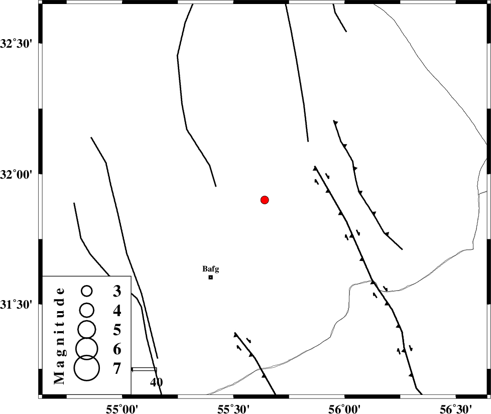
| Location | Lat:31.9 Lon: 55.64 |
| Region | Yazd Province, 41 km North-East of Bafq |
Nearest Cities |
|
| 23 km North West of Kushk, Yazd Province | |
| 36 km North East of Mobarake, Yazd Province | |
| 37 km North West of Behabad, Yazd Province | |
| 40 km North East of Bafq, Yazd Province | |
| 46 km North West of Benestan, Yazd Province | |
| Depth | 36 km |
| Agency | |
Faults within 150 km: |
|
| POSHT_E_BADAM_F (Length: 128 km) , Distance to epicenter: 21 km | |
| KUHBANAN_F (Length: 189 km) , Distance to epicenter: 26 km | |
| SARBALA_F (Length: 92 km) , Distance to epicenter: 31 km | |
| Number of Phases | 5 |
| RMS | 0.1 |
| Number of Stations | 3 |
| Error in Latitude | >3 km |
| Error in Longitude | 4.4 km |
| Error in Depth | 5 km |
Download waveform in seisan format
to download seisan software Click here
to access information about IIEES stations Click here
Amplitude | ||||||||
| UID | Agency | Station | Component | Amplitude | Period | Arrival Time | Proccessing Time | Signal Clip |
| 92303 | IIEES | KRBR | E | 12.9 | 0.24 | 2014-04-28 11:57:28 | 2014-04-29 02:11:00 | n |
| 92304 | IIEES | KRBR | N | 16.3 | 0.24 | 2014-04-28 11:57:29 | 2014-04-29 02:11:00 | n |
Phase | ||||||||||||
| Agency | Station | Component | Phase Type | Phase Quality | First Motion | Observed Arrival Time | Time Residual | Loc. Flag | Input Weight | Distance | Azimuth | |
| IIEES | YZKH | Z | Pg | E | 2014-04-28 11:56:40 | -0.19 | y | 113 | 299 | |||
| IIEES | YZKH | E | Sg | E | 2014-04-28 11:56:54 | 0.14 | y | 113 | 299 | |||
| IIEES | KRBR | Z | Pn | E | 2014-04-28 11:56:56 | -0.01 | y | 238 | 153 | |||
| IIEES | KRBR | E | Sg | E | 2014-04-28 11:57:27 | 0.02 | y | 238 | 153 | |||
| IIEES | BSRN | Z | Pn | E | 2014-04-28 11:57:07 | 0.04 | y | 329 | 88 | |||

 IIEES All Rights Reserved