
Magnitude |
2 |
| Date & Time (UTC) | 2014-05-11 07:55:55.5 |
| Date & Time (Local) | 1393/2/21 12:25:55.5 |
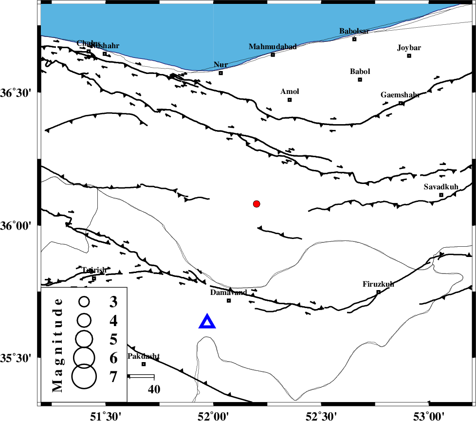
| Location | Lat:36.08 Lon: 52.2 |
| Region | Mazandaran Province, 43 km North-East of Damavand |
Nearest Cities |
|
| 14 km North of Baijan, Mazandaran Province | |
| 19 km South East of Pil, Mazandaran Province | |
| 19 km North of Gaznak, Mazandaran Province | |
| 22 km North of Rineh, Mazandaran Province | |
| 32 km South West of Razkeh, Mazandaran Province | |
| Depth | 14 km |
| Agency | |
Faults within 150 km: |
|
| N_ALBORZ_F (Length: 360 km) , Distance to epicenter: 25 km | |
| KANDOVAN_F (Length: 90 km) , Distance to epicenter: 32 km | |
| KHAZAR_F (Length: 523 km) , Distance to epicenter: 37 km | |
| Number of Phases | 5 |
| RMS | 0.2 |
| Number of Stations | 3 |
| Error in Latitude | >7.2 km |
| Error in Longitude | 6.2 km |
| Error in Depth | 8.7 km |
Download waveform in seisan format
to download seisan software Click here
to access information about IIEES stations Click here
Amplitude | ||||||||
| UID | Agency | Station | Component | Amplitude | Period | Arrival Time | Proccessing Time | Signal Clip |
| 92396 | IIEES | GHVR | E | 15.4 | 0.26 | 2014-05-11 07:57:01 | 2014-05-11 09:35:00 | n |
| 92397 | IIEES | ASAO | E | 8.7 | 0.42 | 2014-05-11 07:57:10 | 2014-05-11 09:35:00 | n |
Phase | ||||||||||||
| Agency | Station | Component | Phase Type | Phase Quality | First Motion | Observed Arrival Time | Time Residual | Loc. Flag | Input Weight | Distance | Azimuth | |
| IIEES | DAMV | Z | Pg | E | 2014-05-11 07:56:05 | -0.05 | y | 54.5 | 203 | |||
| IIEES | GHVR | Z | Pn | E | 2014-05-11 07:56:27 | -0.23 | y | 198 | 206 | |||
| IIEES | GHVR | E | Sg | E | 2014-05-11 07:56:52 | 0.14 | y | 198 | 206 | |||
| IIEES | ASAO | Z | Pn | E | 2014-05-11 07:56:36 | 0.28 | y | 261 | 230 | |||
| IIEES | ASAO | E | Sg | E | 2014-05-11 07:57:09 | -0.13 | y | 261 | 230 | |||