
Magnitude |
3.1 |
| Date & Time (UTC) | 2014-07-28 20:25:33.2 |
| Date & Time (Local) | 1393/5/7 00:55:33.2 |
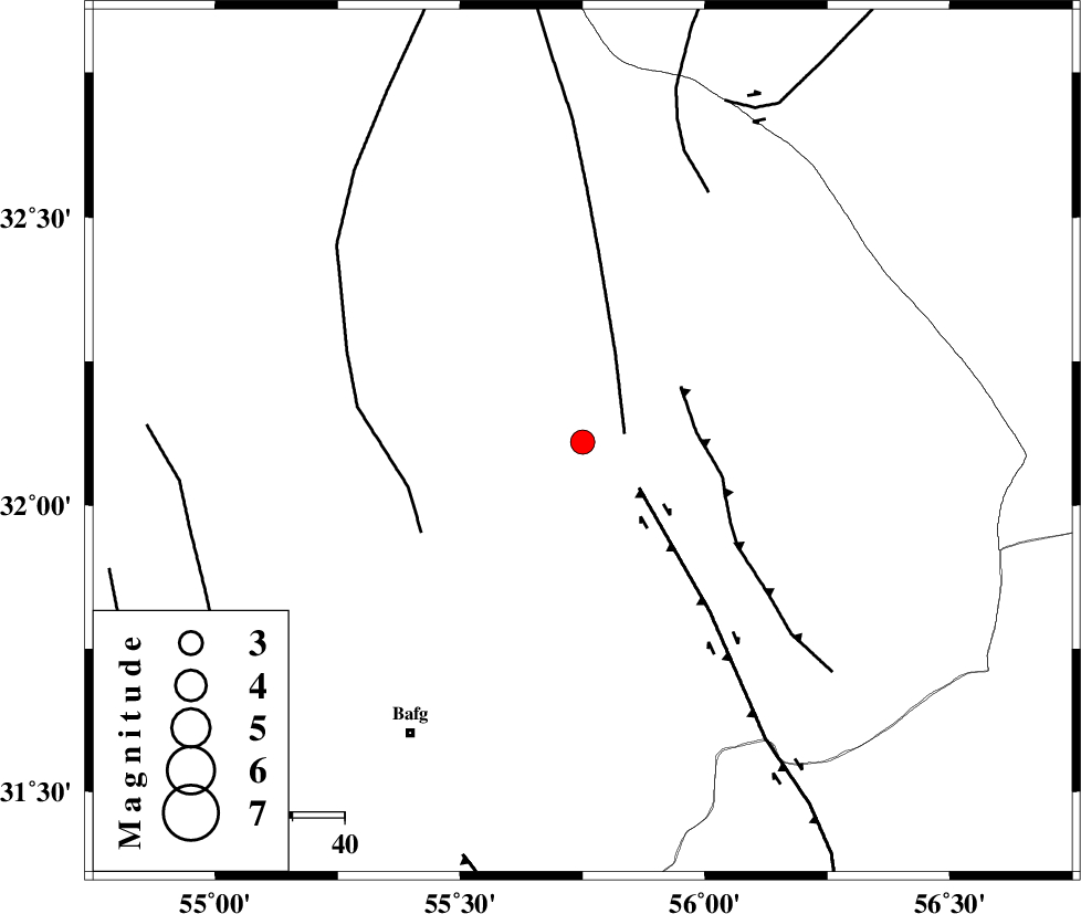
| Location | Lat:32.11 Lon: 55.75 |
| Region | Yazd Province, 65 km North-East of Bafq |
Nearest Cities |
|
| 37 km North West of Behabad, Yazd Province | |
| 41 km North of Kushk, Yazd Province | |
| 52 km North West of Benestan, Yazd Province | |
| 62 km North East of Mobarake, Yazd Province | |
| 65 km North East of Bafq, Yazd Province | |
| Depth | 18 km |
| Agency | |
Faults within 150 km: |
|
| SARBALA_F (Length: 92 km) , Distance to epicenter: 8 km | |
| KUHBANAN_F (Length: 189 km) , Distance to epicenter: 14 km | |
| JAFARABAD_F (Length: 60 km) , Distance to epicenter: 22 km | |
| Number of Phases | 5 |
| RMS | 0 |
| Number of Stations | 3 |
| Error in Latitude | >5 km |
| Error in Longitude | 2.4 km |
| Error in Depth | 9.5 km |
Download waveform in seisan format
to download seisan software Click here
to access information about IIEES stations Click here
Amplitude | ||||||||
| UID | Agency | Station | Component | Amplitude | Period | Arrival Time | Proccessing Time | Signal Clip |
| 92872 | IIEES | YZKH | E | 453 | 0.36 | 2014-07-28 20:26:07 | 2014-07-28 09:43:00 | n |
Phase | ||||||||||||
| Agency | Station | Component | Phase Type | Phase Quality | First Motion | Observed Arrival Time | Time Residual | Loc. Flag | Input Weight | Distance | Azimuth | |
| IIEES | YZKH | Z | Pg | E | 2014-07-28 20:25:52 | 0.02 | y | 114 | 286 | |||
| IIEES | YZKH | E | Sg | E | 2014-07-28 20:26:06 | -0.02 | y | 114 | 286 | |||
| IIEES | TABS | Z | Pg | E | 2014-07-28 20:26:08 | 0.05 | y | 214 | 36 | |||
| IIEES | TABS | N | Sg | E | 2014-07-28 20:26:33 | -0.03 | y | 214 | 36 | |||
| IIEES | BSRN | Z | Pn | E | 2014-07-28 20:26:20 | -0.03 | y | 319 | 92 | |||

 IIEES All Rights Reserved