
Magnitude |
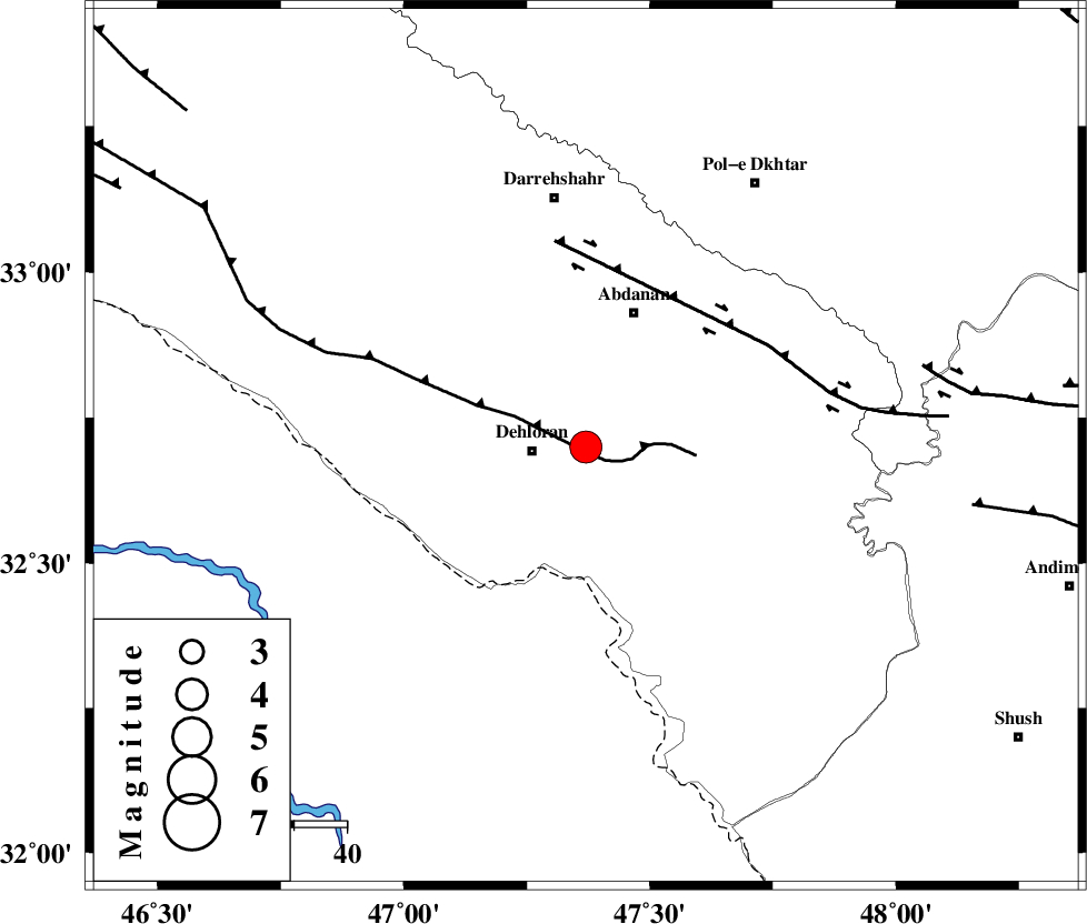
4.1 |
| Date & Time (UTC) | 2014-08-28 07:41:10.5 |
| Date & Time (Local) | 1393/6/6 12:11:10.5 |
| Location | Lat:32.7 Lon: 47.37 |
| Region | Ilam Province, 11 km East of Dehloran |
Nearest Cities |
|
| 10 km North East of Dehloran, Ilam Province | |
| 17 km North of Musian, Ilam Province | |
| 27 km South of Abdanan, Ilam Province | |
| 29 km South West of Sarabbagh, Ilam Province | |
| 39 km South East of Bishehzar, Ilam Province | |
| Depth | 14 km |
| Agency | |
Faults within 150 km: |
|
| MFF6 (Length: 144 km) , Distance to epicenter: 2 km | |
| BALARUD_F_Z1 (Length: 87 km) , Distance to epicenter: 40 km | |
| BALARUD_F_Z3 (Length: 53 km) , Distance to epicenter: 66 km | |
| Number of Phases | 7 |
| RMS | 0.1 |
| Number of Stations | 7 |
| Error in Latitude | >3.4 km |
| Error in Longitude | 8.5 km |
| Error in Depth | 12.2 km |
Download waveform in seisan format
to download seisan software Click here
to access information about IIEES stations Click here
Amplitude | ||||||||
| UID | Agency | Station | Component | Amplitude | Period | Arrival Time | Proccessing Time | Signal Clip |
| 93375 | IIEES | SHGR | N | 2827.5 | 0.84 | 2014-08-28 07:42:03 | 2014-08-28 09:24:00 | n |
| 93376 | IIEES | AHRM | N | 102.8 | 0.68 | 2014-08-28 07:44:29 | 2014-08-28 09:24:00 | n |
Phase | ||||||||||||
| Agency | Station | Component | Phase Type | Phase Quality | First Motion | Observed Arrival Time | Time Residual | Loc. Flag | Input Weight | Distance | Azimuth | |
| IIEES | SHGR | Z | Pn | E | 2014-08-28 07:41:36 | -0.08 | y | 149 | 116 | |||
| IIEES | KHMZ | Z | Pn | E | 2014-08-28 07:41:51 | 0.09 | y | 268 | 64 | |||
| IIEES | ASAO | Z | Pn | E | 2014-08-28 07:41:58 | 0.06 | y | 320 | 49 | |||
| IIEES | ASAO | E | Sg | E | 2014-08-28 07:42:40 | -0.03 | y | 320 | 49 | |||
| IIEES | GHVR | Z | Pn | E | 2014-08-28 07:42:09 | 0.1 | y | 410 | 60 | |||
| IIEES | ZNJK | Z | Pn | E | 2014-08-28 07:42:15 | -0.08 | y | 457 | 15 | |||
| IIEES | CHTH | Z | Pn | E | 2014-08-28 07:42:19 | -0.08 | y | 496 | 43 | |||