
Magnitude |
4.1 |
| Date & Time (UTC) | 2014-09-16 00:39:43.7 |
| Date & Time (Local) | 1393/6/25 05:09:43.7 |
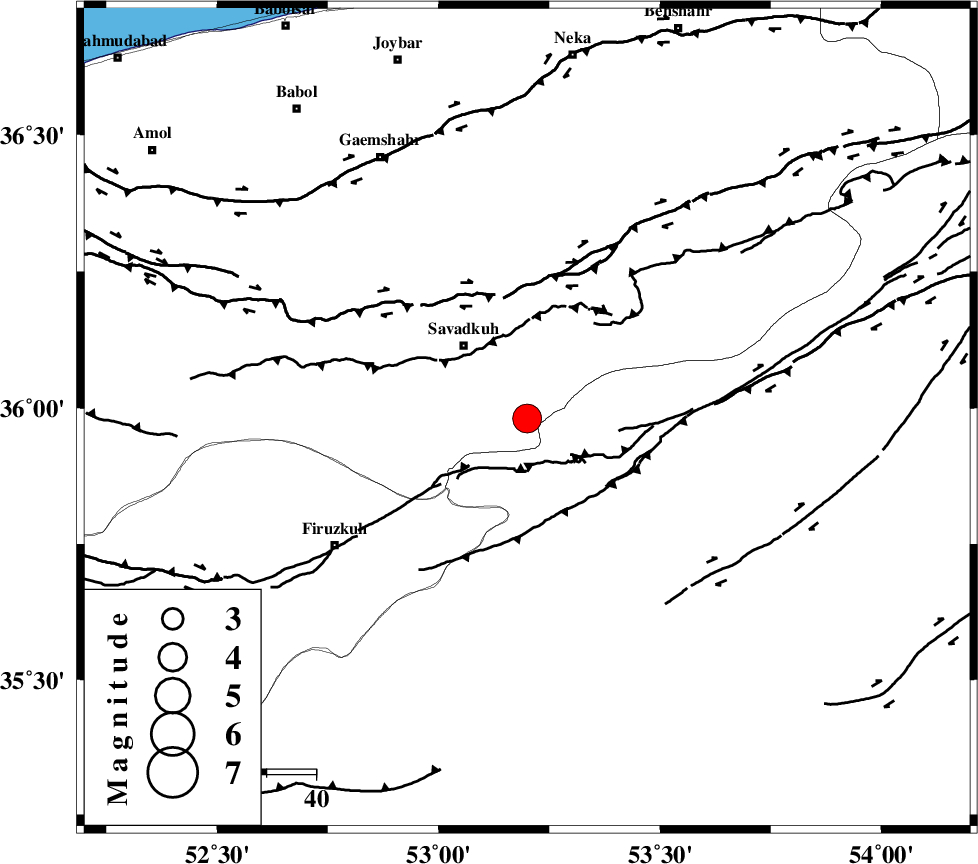
| Location | Lat:35.98 Lon: 53.2 |
| Region | Mazandaran Province, 20 km South-East of Pol-E-Sefid |
Nearest Cities |
|
| 10 km of Sangdeh, Mazandaran Province | |
| 11 km North of Chashem, Semnan Province | |
| 18 km South East of Shurmast-e peyrudbar, Mazandaran Province | |
| 20 km South East of Pol-E-Sefid, Mazandaran Province | |
| 24 km South East of Elahband, Mazandaran Province | |
| Depth | 6 km |
| Agency | |
Faults within 150 km: |
|
| N_ALBORZ_F (Length: 360 km) , Distance to epicenter: 25 km | |
| ATARI_F (Length: 185 km) , Distance to epicenter: 34 km | |
| KHAZAR_F (Length: 523 km) , Distance to epicenter: 58 km | |
| Number of Phases | 8 |
| RMS | 0.3 |
| Number of Stations | 8 |
| Error in Latitude | >6 km |
| Error in Longitude | 4.6 km |
| Error in Depth | 6.3 km |
Download waveform in seisan format
to download seisan software Click here
to access information about IIEES stations Click here
Amplitude | ||||||||
| UID | Agency | Station | Component | Amplitude | Period | Arrival Time | Proccessing Time | Signal Clip |
| 93594 | IIEES | THKV | N | 1520.4 | 0.37 | 2014-09-16 00:40:26 | 2014-09-16 02:27:00 | n |
Phase | ||||||||||||
| Agency | Station | Component | Phase Type | Phase Quality | First Motion | Observed Arrival Time | Time Residual | Loc. Flag | Input Weight | Distance | Azimuth | |
| IIEES | DAMV | Z | Pg | E | 2014-09-16 00:40:04 | 0.17 | y | 118 | 251 | |||
| IIEES | CHTH | Z | Pg | E | 2014-09-16 00:40:15 | -0.19 | y | 188 | 268 | |||
| IIEES | CHTH | N | Sg | E | 2014-09-16 00:40:39 | -0.18 | y | 188 | 268 | |||
| IIEES | GHVR | Z | Pn | E | 2014-09-16 00:40:22 | 0.28 | y | 244 | 228 | |||
| IIEES | ASAO | Z | Pn | E | 2014-09-16 00:40:33 | -0.25 | y | 330 | 242 | |||
| IIEES | ZNJK | Z | Pn | E | 2014-09-16 00:40:44 | 0.49 | y | 413 | 282 | |||
| IIEES | TABS | Z | Pn | E | 2014-09-16 00:40:46 | -0.23 | y | 441 | 125 | |||
| IIEES | GRMI | Z | Pn | E | 2014-09-16 00:41:02 | -0.11 | y | 566 | 305 | |||