
Magnitude |
4.4 |
| Date & Time (UTC) | 2014-09-18 22:29:11.9 |
| Date & Time (Local) | 1393/6/28 02:59:11.9 |
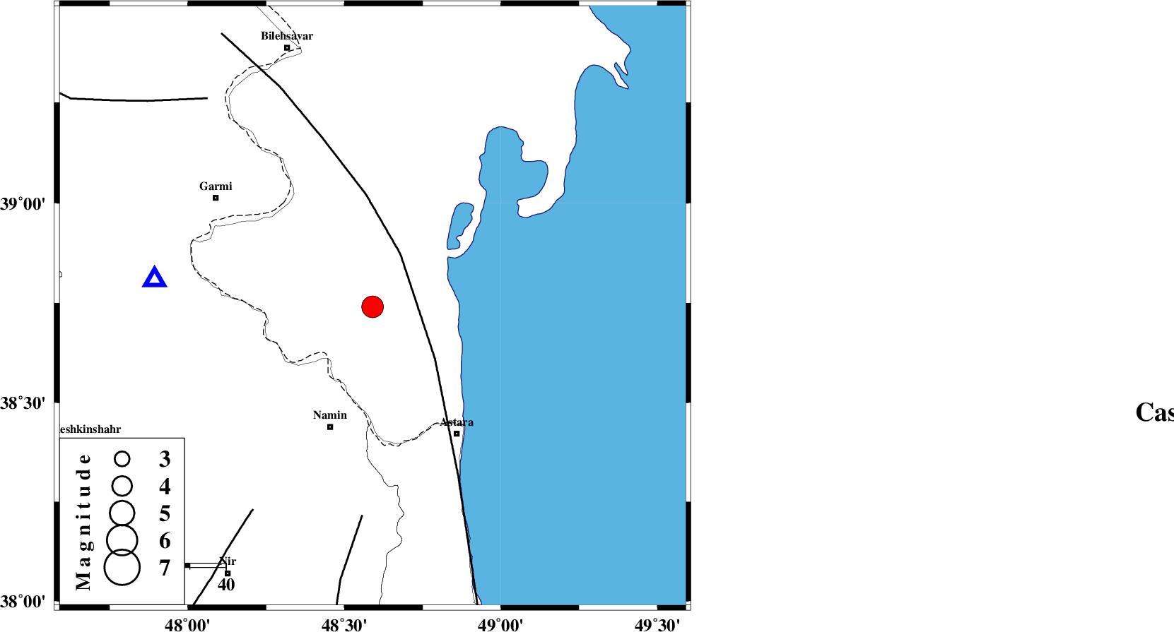
| Location | Lat:38.74 Lon: 48.59 |
| Region | Azerbaijan, 35 km North-East of Namin |
Nearest Cities |
|
| 28 km North East of Lurun, Ardebil Province | |
| 30 km North East of Anbaran, Ardebil Province | |
| 34 km North East of Khaneh zeinian, Ardebil Province | |
| 35 km North East of Namin, Ardebil Province | |
| 40 km North East of Taqi dizaj, Ardebil Province | |
| Depth | 34 km |
| Agency | |
Faults within 150 km: |
|
| TALESH_F (Length: 258 km) , Distance to epicenter: 17 km | |
| SANGAVAR_F (Length: 61 km) , Distance to epicenter: 58 km | |
| BOZQUSH (Length: 70 km) , Distance to epicenter: 66 km | |
| Number of Phases | 9 |
| RMS | 0.2 |
| Number of Stations | 9 |
| Error in Latitude | >7.2 km |
| Error in Longitude | 6.7 km |
| Error in Depth | 5.7 km |
Download waveform in seisan format
to download seisan software Click here
to access information about IIEES stations Click here
Amplitude | ||||||||
| UID | Agency | Station | Component | Amplitude | Period | Arrival Time | Proccessing Time | Signal Clip |
| 93633 | IIEES | GRMI | N | 21065.4 | 0.4 | 2014-09-18 22:29:32 | 2014-09-18 10:55:00 | n |
Phase | ||||||||||||
| Agency | Station | Component | Phase Type | Phase Quality | First Motion | Observed Arrival Time | Time Residual | Loc. Flag | Input Weight | Distance | Azimuth | |
| IIEES | GRMI | Z | Pg | E | 2014-09-18 22:29:23 | 0 | y | 61.1 | 278 | |||
| IIEES | ZNJK | Z | Pn | E | 2014-09-18 22:29:46 | 0.34 | y | 230 | 178 | |||
| IIEES | MAKU | Z | Pn | E | 2014-09-18 22:30:00 | 0.03 | y | 345 | 283 | |||
| IIEES | THKV | Z | Pn | E | 2014-09-18 22:30:03 | -0.39 | y | 373 | 146 | |||
| IIEES | CHTH | Z | Pn | E | 2014-09-18 22:30:05 | 0.01 | y | 386 | 144 | |||
| IIEES | SNGE | Z | Pn | E | 2014-09-18 22:30:09 | -0.4 | y | 419 | 196 | |||
| IIEES | DAMV | Z | Pn | E | 2014-09-18 22:30:14 | 0.14 | y | 457 | 138 | |||
| IIEES | ASAO | Z | Pn | E | 2014-09-18 22:30:18 | 0.24 | y | 482 | 164 | |||
| IIEES | GHVR | Z | Pn | E | 2014-09-18 22:30:23 | -0.03 | y | 529 | 153 | |||