
Magnitude |
3.1 |
| Date & Time (UTC) | 2014-09-23 01:39:32.5 |
| Date & Time (Local) | 1393/7/1 05:09:32.5 |
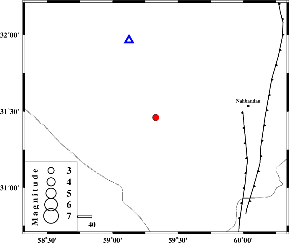
| Location | Lat:31.46 Lon: 59.33 |
| Region | Khorasan(south) Province, 68 km West of Nehbandan |
Nearest Cities |
|
| 68 km West of Nehbandan, Khorasan(south) Province | |
| 80 km South West of Shusef, Khorasan(south) Province | |
| 112 km South of Mokhtaran, Khorasan(south) Province | |
| 120 km South West of Kalateh soleyman, Khorasan(south) Province | |
| 122 km South East of Hamand, Khorasan(south) Province | |
| Depth | 18 km |
| Agency | |
Faults within 150 km: |
|
| W_NEH_F (Length: 158 km) , Distance to epicenter: 63 km | |
| E_NEH_F (Length: 148 km) , Distance to epicenter: 79 km | |
| SEFIDABAD_F (Length: 26 km) , Distance to epicenter: 129 km | |
| Number of Phases | 6 |
| RMS | 0.2 |
| Number of Stations | 5 |
| Error in Latitude | >1.8 km |
| Error in Longitude | 2.8 km |
| Error in Depth | 5.7 km |
Download waveform in seisan format
to download seisan software Click here
to access information about IIEES stations Click here
Amplitude | ||||||||
| UID | Agency | Station | Component | Amplitude | Period | Arrival Time | Proccessing Time | Signal Clip |
| 93663 | IIEES | YZKH | E | 23.9 | 0.6 | 2014-09-23 01:41:47 | 2014-09-23 02:11:00 | n |
Phase | ||||||||||||
| Agency | Station | Component | Phase Type | Phase Quality | First Motion | Observed Arrival Time | Time Residual | Loc. Flag | Input Weight | Distance | Azimuth | |
| IIEES | ZHSF | Z | Pn | E | 2014-09-23 01:40:10 | -0.16 | y | 248 | 146 | |||
| IIEES | SHRT | Z | Pn | E | 2014-09-23 01:40:11 | -0.13 | y | 259 | 20 | |||
| IIEES | SHRT | E | Sg | E | 2014-09-23 01:40:45 | 0.29 | y | 259 | 20 | |||
| IIEES | KRBR | N | Sg | E | 2014-09-23 01:40:56 | 0.23 | y | 296 | 237 | |||
| IIEES | TABS | Z | Pn | E | 2014-09-23 01:40:19 | 0.01 | y | 319 | 320 | |||
| IIEES | TABS | E | Sg | E | 2014-09-23 01:41:02 | -0.24 | y | 319 | 320 | |||

 IIEES All Rights Reserved