
Magnitude |
3.3 |
| Date & Time (UTC) | 2014-10-05 00:18:14.4 |
| Date & Time (Local) | 1393/7/13 03:48:14.4 |
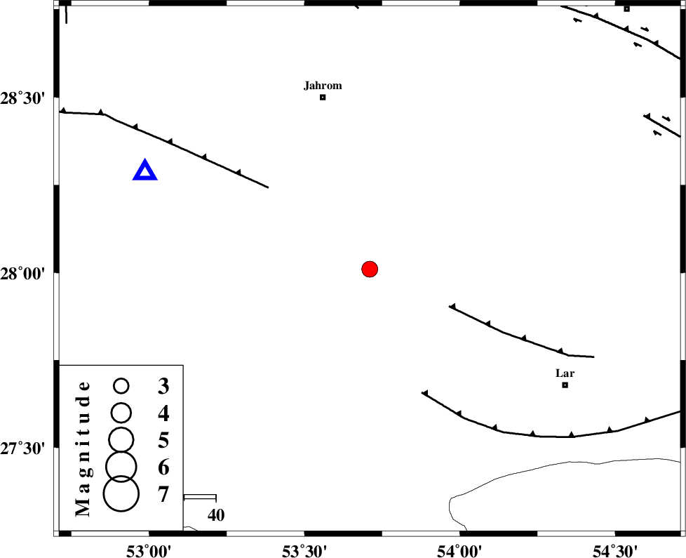
| Location | Lat:28.01 Lon: 53.71 |
| Region | Fars Province, 57 km South-East of Jahrom |
Nearest Cities |
|
| 13 km North of Kureh, Fars Province | |
| 20 km South East of Balafan, Fars Province | |
| 23 km North of Fishur, Fars Province | |
| 25 km South West of Juyam, Fars Province | |
| 32 km North East of Khonj, Fars Province | |
| Depth | 14 km |
| Agency | |
Faults within 150 km: |
|
| BERIZ_F (Length: 49 km) , Distance to epicenter: 28 km | |
| QIR_F (Length: 130 km) , Distance to epicenter: 41 km | |
| LAR_F (Length: 99 km) , Distance to epicenter: 42 km | |
| Number of Phases | 8 |
| RMS | 0.3 |
| Number of Stations | 7 |
| Error in Latitude | >5.7 km |
| Error in Longitude | 2.7 km |
| Error in Depth | 6.4 km |
Download waveform in seisan format
to download seisan software Click here
to access information about IIEES stations Click here
Amplitude | ||||||||
| UID | Agency | Station | Component | Amplitude | Period | Arrival Time | Proccessing Time | Signal Clip |
| 93765 | IIEES | BNDS | N | 195.1 | 0.28 | 2014-10-05 00:19:38 | 2014-10-05 02:40:00 | n |
Phase | ||||||||||||
| Agency | Station | Component | Phase Type | Phase Quality | First Motion | Observed Arrival Time | Time Residual | Loc. Flag | Input Weight | Distance | Azimuth | |
| IIEES | GHIR | Z | Pg | E | 2014-10-05 00:18:27 | -0.33 | y | 77.4 | 294 | |||
| IIEES | BNDS | Z | Pn | E | 2014-10-05 00:18:53 | 0.14 | y | 252 | 105 | |||
| IIEES | BNDS | N | Sg | E | 2014-10-05 00:19:25 | -0.11 | y | 252 | 105 | |||
| IIEES | AHRM | Z | Pn | E | 2014-10-05 00:18:53 | 0.31 | y | 255 | 292 | |||
| IIEES | KRBR | Z | Pn | E | 2014-10-05 00:19:07 | -0.28 | y | 369 | 53 | |||
| IIEES | YZKH | Z | Pn | E | 2014-10-05 00:19:23 | -0.04 | y | 493 | 10 | |||
| IIEES | BSRN | Z | Pn | E | 2014-10-05 00:19:47 | 0.52 | y | 682 | 49 | |||
| IIEES | TABS | Z | Pn | E | 2014-10-05 00:19:49 | 0.02 | y | 705 | 27 | |||