
Magnitude |
3.3 |
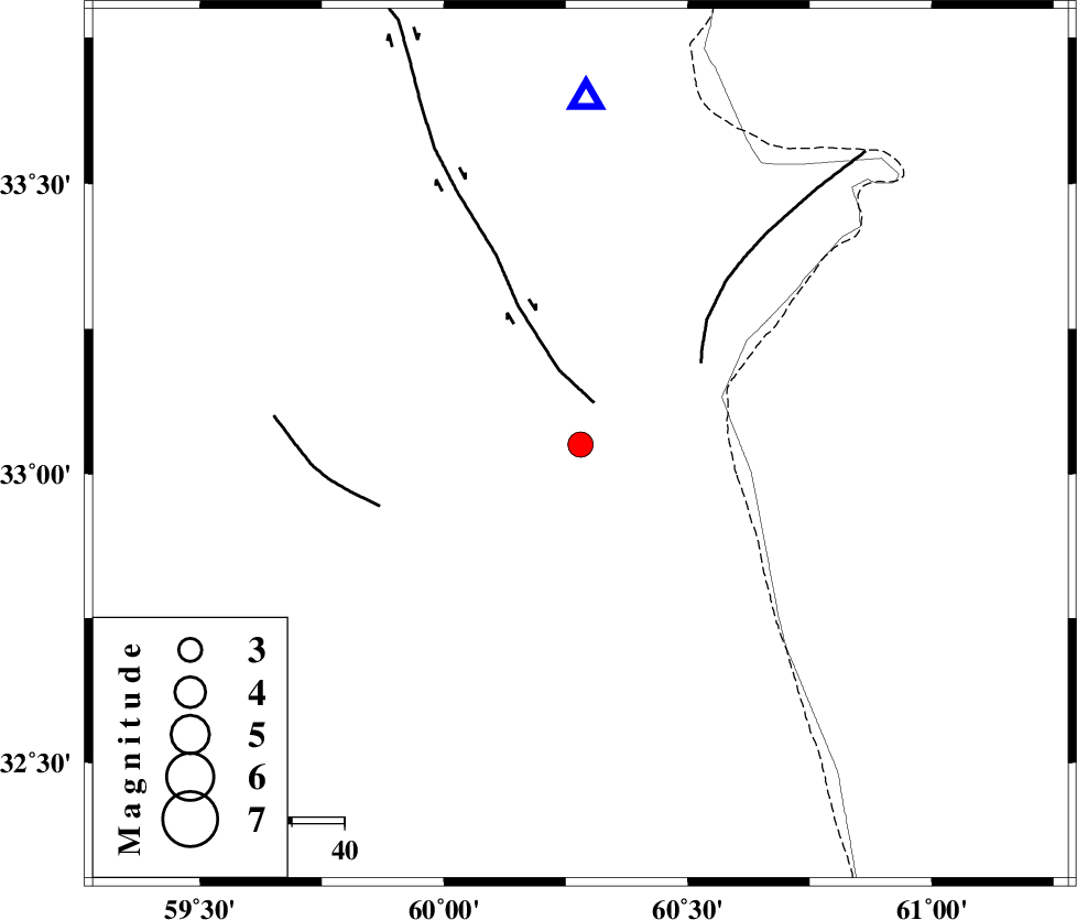
| Date & Time (UTC) | 2014-11-09 15:52:38.6 |
| Date & Time (Local) | 1393/8/18 19:22:38.6 |
| Location | Lat:33.05 Lon: 60.28 |
| Region | Khorasan(south) Province, 66 km North-East of Sarbisheh |
Nearest Cities |
|
| 8 km North of Gazik, Khorasan(south) Province | |
| 27 km North of Tabas masina, Khorasan(south) Province | |
| 42 km North East of Darmian, Khorasan(south) Province | |
| 53 km North East of Asadieh, Khorasan(south) Province | |
| 54 km North East of Gasak, Khorasan(south) Province | |
| Depth | 14 km |
| Agency | |
Faults within 150 km: |
|
| ABRIZ_F (Length: 114 km) , Distance to epicenter: 8 km | |
| PATARGAN_F (Length: 52 km) , Distance to epicenter: 28 km | |
| NOZAD_F (Length: 27 km) , Distance to epicenter: 40 km | |
| Number of Phases | 6 |
| RMS | 0 |
| Number of Stations | 4 |
| Error in Latitude | >1 km |
| Error in Longitude | 2 km |
| Error in Depth | 3.6 km |
Download waveform in seisan format
to download seisan software Click here
to access information about IIEES stations Click here
Amplitude | ||||||||
| UID | Agency | Station | Component | Amplitude | Period | Arrival Time | Proccessing Time | Signal Clip |
| 94238 | IIEES | YZKH | E | 20.6 | 0.52 | 2014-11-09 15:55:18 | 2014-11-09 04:17:00 | n |
Phase | ||||||||||||
| Agency | Station | Component | Phase Type | Phase Quality | First Motion | Observed Arrival Time | Time Residual | Loc. Flag | Input Weight | Distance | Azimuth | |
| IIEES | SHRT | Z | Pg | E | 2014-11-09 15:52:50 | -0.07 | y | 65.8 | 1 | |||
| IIEES | SHRT | N | Sg | E | 2014-11-09 15:52:58 | 0.03 | y | 65.8 | 1 | |||
| IIEES | BSRN | Z | Pg | E | 2014-11-09 15:53:05 | 0 | y | 162 | 222 | |||
| IIEES | BSRN | E | Sg | E | 2014-11-09 15:53:25 | -0.01 | y | 162 | 222 | |||
| IIEES | TABS | Z | Pn | E | 2014-11-09 15:53:23 | 0.08 | y | 302 | 284 | |||
| IIEES | TABS | N | Sg | E | 2014-11-09 15:54:03 | -0.03 | y | 302 | 284 | |||

 IIEES All Rights Reserved