
Magnitude |
5 |
| Date & Time (UTC) | 2015-01-10 17:03:07.3 |
| Date & Time (Local) | 1393/10/20 20:33:07.3 |
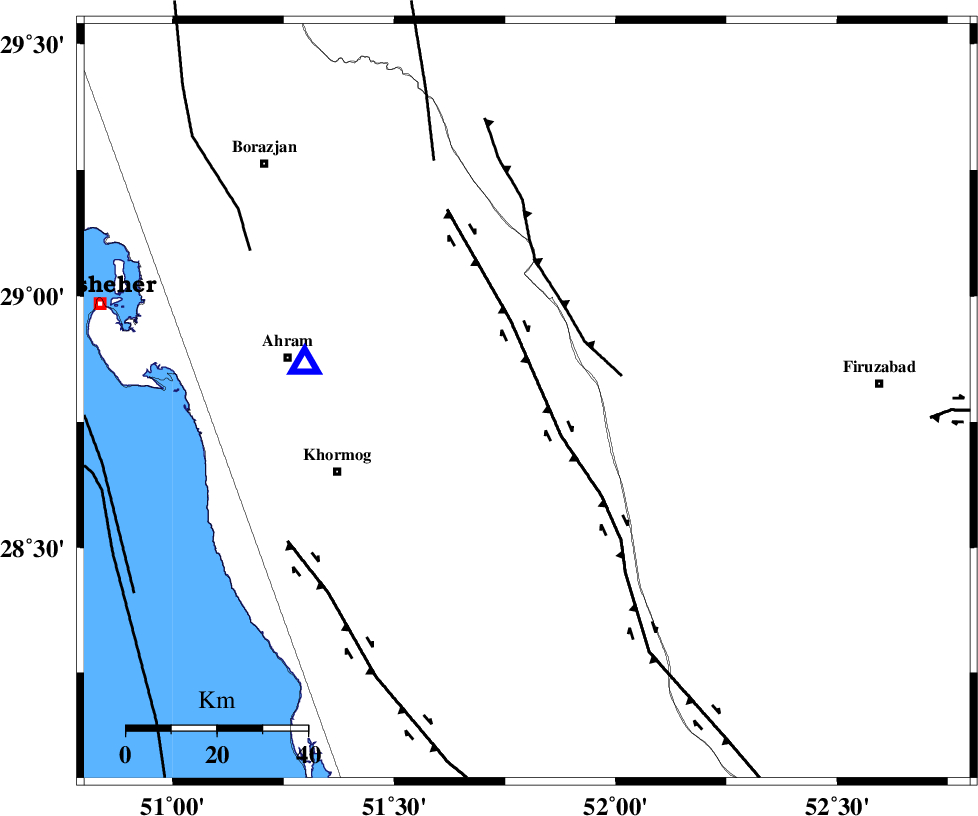
| Location | Lat:28.79 Lon: 51.8 |
| Region | Bushehr Province, 29 km West of Farashband |
Nearest Cities |
|
| 29 km South West of Aviz, Fars Province | |
| 29 km West of Farashband, Fars Province | |
| 37 km South East of Kalameh, Bushehr Province | |
| 40 km South West of Nujin, Fars Province | |
| 45 km North of Shanbeh, Bushehr Province | |
| Depth | 19 km |
| Agency | |
Faults within 150 km: |
|
| MFF5 (Length: 74 km) , Distance to epicenter: 31 km | |
| BORAZJAN_F (Length: 168 km) , Distance to epicenter: 47 km | |
| KAREBASS_F (Length: 98 km) , Distance to epicenter: 48 km | |
| Number of Phases | 9 |
| RMS | 0.1 |
| Number of Stations | 10 |
| Error in Latitude | >5.7 km |
| Error in Longitude | 2.9 km |
| Error in Depth | 8.2 km |
Download waveform in seisan format
to download seisan software Click here
to access information about IIEES stations Click here
Amplitude | ||||||||
| UID | Agency | Station | Component | Amplitude | Period | Arrival Time | Proccessing Time | Signal Clip |
| 94749 | IIEES | SNGE | N | 210.2 | 0.44 | 2015-01-10 17:06:24 | 2015-01-10 05:36:00 | n |
Phase | ||||||||||||
| Agency | Station | Component | Phase Type | Phase Quality | First Motion | Observed Arrival Time | Time Residual | Loc. Flag | Input Weight | Distance | Azimuth | |
| IIEES | AHRM | Z | Pg | E | 2015-01-10 17:03:16 | 0 | y | 50.1 | 280 | |||
| IIEES | NASN | Z | Pn | E | 2015-01-10 17:04:11 | -0.06 | y | 455 | 12 | |||
| IIEES | SHGR | Z | Pn | E | 2015-01-10 17:04:12 | -0.02 | y | 468 | 323 | |||
| IIEES | YZKH | Z | Pn | E | 2015-01-10 17:04:14 | 0 | y | 481 | 33 | |||
| IIEES | KRBR | Z | Pn | E | 2015-01-10 17:04:16 | -0.02 | y | 499 | 73 | |||
| IIEES | KHMZ | Z | Pn | E | 2015-01-10 17:04:26 | 0.1 | y | 576 | 343 | |||
| IIEES | GHVR | Z | Pn | E | 2015-01-10 17:04:33 | -0.06 | y | 634 | 355 | |||
| IIEES | ASAO | Z | Pn | E | 2015-01-10 17:04:36 | 0 | y | 661 | 346 | |||
| IIEES | TABS | Z | Pn | E | 2015-01-10 17:04:46 | 0.11 | y | 740 | 42 | |||